Area Overview for WA3 6QH
Photos of WA3 6QH
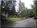
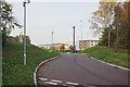
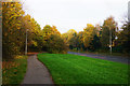
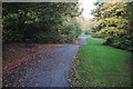
31 photos from this area
Area Information
Key information about the WA3 6QH including its size, population, and administrative classification.
- Area Type
- Postcode
- Area Size
- 3.0 hectares
- Population
- 1555
- Population Density
- 7036 people/km²
House Prices in WA3 6QH
75
Properties
£96,185
Average Sold Price
£24,000
Lowest Price
£220,000
Highest Price
Showing 75 properties
| Address | Type | Beds | Baths | Last Sale Price | Last Sale Date | |
|---|---|---|---|---|---|---|
| 89 Dove Close, Birchwood, Warrington, WA3 6QH | Terraced | 2 | 1 | £170,000 | Nov 2024 | |
| 17 Dove Close, Birchwood, Warrington, WA3 6QH | Semi-detached | 2 | 1 | £192,000 | Jul 2024 | |
| 6 Dove Close, Birchwood, Warrington, WA3 6QH | Semi-detached | 3 | 1 | £155,000 | Dec 2023 | |
| 61 Dove Close, Birchwood, Warrington, WA3 6QH | Terraced | 2 | 1 | £155,000 | Aug 2023 | |
| 12 Dove Close, Birchwood, Warrington, WA3 6QH | Semi-detached | 2 | 1 | £163,500 | Jun 2023 | |
| 45 Dove Close, Birchwood, Warrington, WA3 6QH | Flat | 2 | 1 | £105,000 | Jun 2023 | |
| 4 Dove Close, Birchwood, Warrington, WA3 6QH | Semi-detached | 2 | 1 | £190,000 | May 2023 | |
| 2 Dove Close, Birchwood, Warrington, WA3 6QH | Detached | 2 | 1 | £220,000 | Feb 2023 | |
| 48 Dove Close, Birchwood, Warrington, WA3 6QH | Terraced | 2 | - | £165,000 | Dec 2022 | |
| 91 Dove Close, Birchwood, Warrington, WA3 6QH | Terraced | 2 | 1 | £172,600 | Dec 2022 |
Page 1 of 8
Energy Efficiency in WA3 6QH
Amenities
Schools
| Rank | School | Type | Entry gender | Ages |
|---|
Explore more schools in this area
Go to Schools tabDemographics
Household Size
One person
most common
Accommodation Type
Houses
most common
Tenure
27
majority
Ethnic Group
White
most common
Religion
N/A
most common
Household Composition
N/A
most common
Age
47
median
Adults (30-64 years)
most common
Household Deprivation
N/A
with no deprivation
NS-SEC
21
in Lower managerial occupations
Explore more demographic insights in this area
Go to Demographics tabPlanning
Planning Constraints
- Flood RiskPremium
- Ramsar Wetland SitesPremium
- Area of Outstanding Natural BeautyPremium
- Protected Nature ReservePremium
- Protected WoodlandPremium