Area Overview for WA3 3XJ
Photos of WA3 3XJ


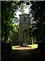

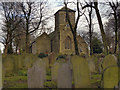
32 photos from this area
Area Information
Key information about the WA3 3XJ including its size, population, and administrative classification.
- Area Type
- Postcode
- Area Size
- 2.8 hectares
- Population
- 1556
- Population Density
- 3299 people/km²
House Prices in WA3 3XJ
57
Properties
£119,273
Average Sold Price
£39,000
Lowest Price
£280,000
Highest Price
Showing 57 properties
| Address | Type | Beds | Baths | Last Sale Price | Last Sale Date | |
|---|---|---|---|---|---|---|
| 49 Cottesmore Way, Golborne, WA3 3XJ | Detached | 4 | 2 | £280,000 | Jul 2025 | |
| 39 Cottesmore Way, Golborne, WA3 3XJ | Semi-detached | 3 | 1 | £227,000 | Mar 2025 | |
| 35 Cottesmore Way, Golborne, WA3 3XJ | Semi-detached | 3 | 1 | £199,950 | Jul 2024 | |
| 97 Cottesmore Way, Golborne, WA3 3XJ | Semi-detached | 3 | 1 | £155,000 | Jul 2023 | |
| 1 Cottesmore Way, Golborne, WA3 3XJ | Semi-detached | 2 | 1 | £240,000 | Apr 2023 | |
| 43 Cottesmore Way, Golborne, WA3 3XJ | house | - | - | £125,000 | Dec 2021 | |
| 61 Cottesmore Way, Golborne, WA3 3XJ | Detached | 3 | - | £144,000 | Feb 2021 | |
| 63 Cottesmore Way, Golborne, WA3 3XJ | house | - | - | £117,500 | Nov 2020 | |
| 111 Cottesmore Way, Golborne, WA3 3XJ | Bungalow | - | - | £130,000 | Nov 2020 | |
| 47 Cottesmore Way, Golborne, WA3 3XJ | house | 2 | 1 | £101,500 | Oct 2020 |
Page 1 of 6
Energy Efficiency in WA3 3XJ
Amenities
Schools
| Rank | School | Type | Entry gender | Ages |
|---|
Explore more schools in this area
Go to Schools tabDemographics
Household Size
One person
most common
Accommodation Type
Houses
most common
Tenure
52
majority
Ethnic Group
White
most common
Religion
N/A
most common
Household Composition
N/A
most common
Age
47
median
Adults (30-64 years)
most common
Household Deprivation
N/A
with no deprivation
NS-SEC
21
in Lower managerial occupations
Explore more demographic insights in this area
Go to Demographics tabPlanning
Planning Constraints
- Flood RiskPremium
- Ramsar Wetland SitesPremium
- Area of Outstanding Natural BeautyPremium
- Protected Nature ReservePremium
- Protected WoodlandPremium