Area Overview for WA3 3UN
Photos of WA3 3UN

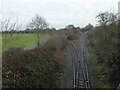
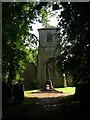
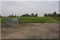
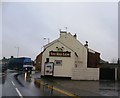
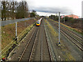

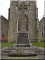
32 photos from this area
Area Information
Key information about the WA3 3UN including its size, population, and administrative classification.
- Area Type
- Postcode
- Area Size
- 5.9 hectares
- Population
- 1628
- Population Density
- 1985 people/km²
House Prices in WA3 3UN
14
Properties
£106,642
Average Sold Price
£10,000
Lowest Price
£335,000
Highest Price
Showing 14 properties
| Address | Type | Beds | Baths | Last Sale Price | Last Sale Date | |
|---|---|---|---|---|---|---|
| 34 Ashton Road, Golborne, WA3 3UN | house | 3 | 1 | £122,000 | Jul 2024 | |
| 44 Ashton Road, Golborne, WA3 3UN | Terraced | 3 | 1 | £83,000 | Jul 2024 | |
| 48 Ashton Road, Golborne, WA3 3UN | Terraced | 3 | 1 | £135,000 | Mar 2024 | |
| 20 Ashton Road, Golborne, WA3 3UN | Bungalow | 3 | 1 | £140,000 | Jun 2019 | |
| 22 Ashton Road, Golborne, WA3 3UN | Bungalow | - | - | £179,500 | Oct 2018 | |
| 20A Ashton Road, Golborne, WA3 3UN | Semi-detached | - | - | £335,000 | Apr 2009 | |
| 40 Ashton Road, Golborne, WA3 3UN | Detached | 3 | 3 | £71,000 | Sep 2008 | |
| 42 Ashton Road, Golborne, WA3 3UN | Detached | 3 | 3 | £71,000 | Sep 2008 | |
| 32 Ashton Road, Golborne, WA3 3UN | Semi-detached | - | - | £56,950 | Jan 2004 | |
| 30 Ashton Road, Golborne, WA3 3UN | Semi-detached | - | - | £35,000 | Oct 1997 |
Page 1 of 2
Energy Efficiency in WA3 3UN
Amenities
Schools
| Rank | School | Type | Entry gender | Ages |
|---|
Explore more schools in this area
Go to Schools tabDemographics
Household Size
Two person
most common
Accommodation Type
Houses
most common
Tenure
63
majority
Ethnic Group
White
most common
Religion
N/A
most common
Household Composition
N/A
most common
Age
47
median
Adults (30-64 years)
most common
Household Deprivation
N/A
with no deprivation
NS-SEC
24
in Lower managerial occupations
Explore more demographic insights in this area
Go to Demographics tabPlanning
Planning Constraints
- Flood RiskPremium
- Ramsar Wetland SitesPremium
- Area of Outstanding Natural BeautyPremium
- Protected Nature ReservePremium
- Protected WoodlandPremium