Area Overview for WA3 3DD
Photos of WA3 3DD
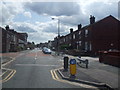
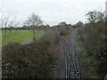
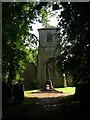
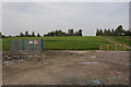
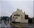
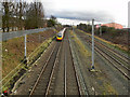
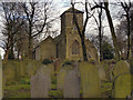
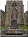
32 photos from this area
Area Information
Key information about the WA3 3DD including its size, population, and administrative classification.
- Area Type
- Postcode
- Area Size
- 6098 m²
- Population
- 1628
- Population Density
- 1985 people/km²
House Prices in WA3 3DD
25
Properties
£97,434
Average Sold Price
£25,000
Lowest Price
£180,000
Highest Price
Showing 25 properties
| Address | Type | Beds | Baths | Last Sale Price | Last Sale Date | |
|---|---|---|---|---|---|---|
| 18 Charles Street, Golborne, WA3 3DD | Terraced | 2 | 1 | £106,500 | Sep 2025 | |
| 42 Charles Street, Golborne, WA3 3DD | Terraced | 3 | 1 | £143,000 | May 2025 | |
| 12 Charles Street, Golborne, WA3 3DD | Terraced | 3 | 1 | £90,000 | Feb 2025 | |
| 16 Charles Street, Golborne, WA3 3DD | Retail | 4 | 1 | £125,000 | Oct 2022 | |
| 34 Charles Street, Golborne, WA3 3DD | house | - | - | £165,000 | Aug 2022 | |
| 36 Charles Street, Golborne, WA3 3DD | Terraced | 3 | 1 | £180,000 | Jun 2022 | |
| 24 Charles Street, Golborne, WA3 3DD | house | - | - | £139,950 | Jan 2022 | |
| 10 Charles Street, Golborne, WA3 3DD | Terraced | 3 | 1 | £80,000 | Jan 2019 | |
| 22 Charles Street, Golborne, WA3 3DD | house | - | - | £83,000 | Sep 2018 | |
| 4 Charles Street, Golborne, WA3 3DD | Terraced | 3 | 1 | £83,000 | Sep 2016 |
Page 1 of 3
Energy Efficiency in WA3 3DD
Amenities
Schools
| Rank | School | Type | Entry gender | Ages |
|---|
Explore more schools in this area
Go to Schools tabDemographics
Household Size
Two person
most common
Accommodation Type
Houses
most common
Tenure
63
majority
Ethnic Group
White
most common
Religion
N/A
most common
Household Composition
N/A
most common
Age
47
median
Adults (30-64 years)
most common
Household Deprivation
N/A
with no deprivation
NS-SEC
24
in Lower managerial occupations
Explore more demographic insights in this area
Go to Demographics tabPlanning
Planning Constraints
- Flood RiskPremium
- Ramsar Wetland SitesPremium
- Area of Outstanding Natural BeautyPremium
- Protected Nature ReservePremium
- Protected WoodlandPremium