Area Overview for WA2 8XJ
Photos of WA2 8XJ
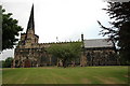
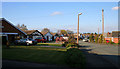


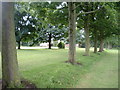


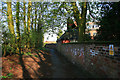
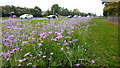
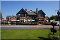

60 photos from this area
Area Information
Key information about the WA2 8XJ including its size, population, and administrative classification.
- Area Type
- Postcode
- Area Size
- 1.1 hectares
- Population
- 2416
- Population Density
- 308 people/km²
House Prices in WA2 8XJ
14
Properties
£322,179
Average Sold Price
£155,000
Lowest Price
£560,000
Highest Price
Showing 14 properties
| Address | Type | Beds | Baths | Last Sale Price | Last Sale Date | |
|---|---|---|---|---|---|---|
| 4 Beckett Drive, Winwick, Warrington, WA2 8XJ | Detached | 4 | 3 | £520,000 | Aug 2025 | |
| 1 Beckett Drive, Winwick, Warrington, WA2 8XJ | house | 4 | - | £515,000 | May 2025 | |
| 7 Beckett Drive, Winwick, Warrington, WA2 8XJ | Detached | 4 | 3 | £560,000 | May 2024 | |
| 12 Beckett Drive, Winwick, Warrington, WA2 8XJ | Detached | 4 | 2 | £365,000 | Oct 2015 | |
| 14 Beckett Drive, Winwick, Warrington, WA2 8XJ | Detached | 4 | 3 | £342,000 | Dec 2013 | |
| 2 Beckett Drive, Winwick, Warrington, WA2 8XJ | Detached | 4 | 2 | £275,000 | Mar 2012 | |
| 10 Beckett Drive, Winwick, Warrington, WA2 8XJ | house | - | - | £375,000 | Mar 2008 | |
| 9 Beckett Drive, Winwick, Warrington, WA2 8XJ | house | - | - | £328,500 | Aug 2004 | |
| 11 Beckett Drive, Winwick, Warrington, WA2 8XJ | house | 4 | 3 | £280,000 | Aug 2003 | |
| 15 Beckett Drive, Winwick, Warrington, WA2 8XJ | Detached | - | - | £220,000 | Dec 2001 |
Page 1 of 2
Energy Efficiency in WA2 8XJ
Amenities
Schools
| Rank | School | Type | Entry gender | Ages |
|---|
Explore more schools in this area
Go to Schools tabDemographics
Household Size
Family (3-5 people)
most common
Accommodation Type
Houses
most common
Tenure
88
majority
Ethnic Group
White
most common
Religion
N/A
most common
Household Composition
N/A
most common
Age
47
median
Adults (30-64 years)
most common
Household Deprivation
N/A
with no deprivation
NS-SEC
46
in Lower managerial occupations
Explore more demographic insights in this area
Go to Demographics tabPlanning
Planning Constraints
- Flood RiskPremium
- Ramsar Wetland SitesPremium
- Area of Outstanding Natural BeautyPremium
- Protected Nature ReservePremium
- Protected WoodlandPremium