Area Overview for WA2 8EU
Photos of WA2 8EU

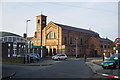
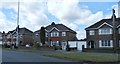
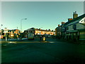
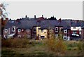

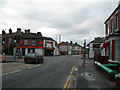
41 photos from this area
Area Information
Key information about the WA2 8EU including its size, population, and administrative classification.
- Area Type
- Postcode
- Area Size
- 1.9 hectares
- Population
- 1489
- Population Density
- 5980 people/km²
House Prices in WA2 8EU
42
Properties
£124,636
Average Sold Price
£34,987
Lowest Price
£281,000
Highest Price
Showing 42 properties
| Address | Type | Beds | Baths | Last Sale Price | Last Sale Date | |
|---|---|---|---|---|---|---|
| 45 Withers Avenue, Orford, Warrington, WA2 8EU | Semi-detached | 3 | 1 | £190,000 | Jul 2023 | |
| 34 Withers Avenue, Orford, Warrington, WA2 8EU | Semi-detached | 3 | 1 | £281,000 | Oct 2022 | |
| 32 Withers Avenue, Orford, Warrington, WA2 8EU | Semi-detached | 3 | 2 | £164,000 | May 2021 | |
| 4 Withers Avenue, Orford, Warrington, WA2 8EU | Semi-detached | 3 | 1 | £139,000 | May 2020 | |
| 8 Withers Avenue, Orford, Warrington, WA2 8EU | Semi-detached | 4 | - | £190,000 | Jul 2019 | |
| 73 Withers Avenue, Orford, Warrington, WA2 8EU | Semi-detached | 3 | - | £155,000 | Mar 2019 | |
| 22 Withers Avenue, Orford, Warrington, WA2 8EU | house | - | - | £181,000 | Feb 2017 | |
| 2 Withers Avenue, Orford, Warrington, WA2 8EU | house | - | - | £207,000 | Apr 2016 | |
| 67 Withers Avenue, Orford, Warrington, WA2 8EU | Semi-detached | 3 | 1 | £137,500 | Jun 2014 | |
| 31 Withers Avenue, Orford, Warrington, WA2 8EU | Semi-detached | 3 | 1 | £149,950 | Jun 2014 |
Page 1 of 5
Energy Efficiency in WA2 8EU
Amenities
Schools
| Rank | School | Type | Entry gender | Ages |
|---|
Explore more schools in this area
Go to Schools tabDemographics
Household Size
Family (3-5 people)
most common
Accommodation Type
Houses
most common
Tenure
89
majority
Ethnic Group
White
most common
Religion
N/A
most common
Household Composition
N/A
most common
Age
47
median
Adults (30-64 years)
most common
Household Deprivation
N/A
with no deprivation
NS-SEC
28
in Lower managerial occupations
Explore more demographic insights in this area
Go to Demographics tabPlanning
Planning Constraints
- Flood RiskPremium
- Ramsar Wetland SitesPremium
- Area of Outstanding Natural BeautyPremium
- Protected Nature ReservePremium
- Protected WoodlandPremium