Area Overview for WA2 7SS
Photos of WA2 7SS
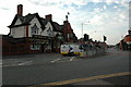
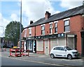
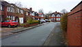
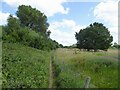
18 photos from this area
Area Information
Key information about the WA2 7SS including its size, population, and administrative classification.
- Area Type
- Postcode
- Area Size
- 2.7 hectares
- Population
- 1638
- Population Density
- 2913 people/km²
House Prices in WA2 7SS
17
Properties
£90,942
Average Sold Price
£958
Lowest Price
£214,000
Highest Price
Showing 17 properties
| Address | Type | Beds | Baths | Last Sale Price | Last Sale Date | |
|---|---|---|---|---|---|---|
| 69 Orford Road, Warrington, WA2 7SS | Retail | 3 | 1 | £214,000 | Aug 2022 | |
| 73 Orford Road, Warrington, WA2 7SS | Semi-detached | 3 | 1 | £958 | May 2022 | |
| 85 Orford Road, Warrington, WA2 7SS | Semi-detached | 3 | 1 | £122,000 | Dec 2019 | |
| 89 Orford Road, Warrington, WA2 7SS | Semi-detached | - | - | £959 | Sep 2017 | |
| 67 Orford Road, Warrington, WA2 7SS | Semi-detached | 3 | - | £132,000 | Mar 2016 | |
| 59 Orford Road, Warrington, WA2 7SS | Semi-detached | 3 | - | £155,000 | Jan 2016 | |
| 63 Orford Road, Warrington, WA2 7SS | house | - | - | £125,000 | Jul 2011 | |
| 61 Orford Road, Warrington, WA2 7SS | Semi-detached | 3 | 1 | £59,000 | May 2002 | |
| 71 Orford Road, Warrington, WA2 7SS | house | - | - | £54,000 | May 2000 | |
| 83 Orford Road, Warrington, WA2 7SS | Semi-detached | - | - | £46,500 | Jul 1996 |
Page 1 of 2
Energy Efficiency in WA2 7SS
Amenities
Schools
| Rank | School | Type | Entry gender | Ages |
|---|
Explore more schools in this area
Go to Schools tabDemographics
Household Size
Family (3-5 people)
most common
Accommodation Type
Houses
most common
Tenure
85
majority
Ethnic Group
White
most common
Religion
N/A
most common
Household Composition
N/A
most common
Age
47
median
Adults (30-64 years)
most common
Household Deprivation
N/A
with no deprivation
NS-SEC
33
in Lower managerial occupations
Explore more demographic insights in this area
Go to Demographics tabPlanning
Planning Constraints
- Flood RiskPremium
- Ramsar Wetland SitesPremium
- Area of Outstanding Natural BeautyPremium
- Protected Nature ReservePremium
- Protected WoodlandPremium