Area Overview for WA16 8BT
Photos of WA16 8BT

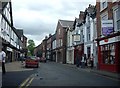
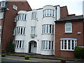


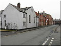
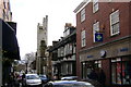

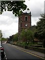

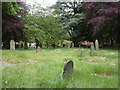

100 photos from this area
Area Information
Key information about the WA16 8BT including its size, population, and administrative classification.
- Area Type
- Postcode
- Area Size
- 1.6 hectares
- Population
- 1953
- Population Density
- 4789 people/km²
House Prices in WA16 8BT
33
Properties
£378,579
Average Sold Price
£94,000
Lowest Price
£690,000
Highest Price
Showing 33 properties
| Address | Type | Beds | Baths | Last Sale Price | Last Sale Date | |
|---|---|---|---|---|---|---|
| 19 Thorneyholme Drive, Knutsford, WA16 8BT | Semi-detached | 3 | 2 | £587,500 | Mar 2025 | |
| 20 Thorneyholme Drive, Knutsford, WA16 8BT | Semi-detached | 3 | 1 | £585,000 | Feb 2025 | |
| 2 Thorneyholme Drive, Knutsford, WA16 8BT | Semi-detached | 5 | 1 | £690,000 | Oct 2024 | |
| 13 Thorneyholme Drive, Knutsford, WA16 8BT | Semi-detached | 3 | 1 | £460,000 | Sep 2024 | |
| 23 Thorneyholme Drive, Knutsford, WA16 8BT | Semi-detached | 3 | - | £527,500 | Jan 2023 | |
| 4 Thorneyholme Drive, Knutsford, WA16 8BT | house | - | - | £445,000 | Oct 2021 | |
| 15 Thorneyholme Drive, Knutsford, WA16 8BT | Semi-detached | 3 | 1 | £484,000 | Mar 2021 | |
| 24 Thorneyholme Drive, Knutsford, WA16 8BT | Semi-detached | 3 | 1 | £450,000 | Jan 2020 | |
| 27 Thorneyholme Drive, Knutsford, WA16 8BT | Semi-detached | 3 | 1 | £415,000 | May 2019 | |
| 25 Thorneyholme Drive, Knutsford, WA16 8BT | house | - | - | £416,000 | Mar 2019 |
Page 1 of 4
Energy Efficiency in WA16 8BT
Amenities
Schools
| Rank | School | Type | Entry gender | Ages |
|---|
Explore more schools in this area
Go to Schools tabDemographics
Household Size
One person
most common
Accommodation Type
Houses
most common
Tenure
62
majority
Ethnic Group
White
most common
Religion
N/A
most common
Household Composition
N/A
most common
Age
47
median
Adults (30-64 years)
most common
Household Deprivation
N/A
with no deprivation
NS-SEC
41
in Lower managerial occupations
Explore more demographic insights in this area
Go to Demographics tabPlanning
Planning Constraints
- Flood RiskPremium
- Ramsar Wetland SitesPremium
- Area of Outstanding Natural BeautyPremium
- Protected Nature ReservePremium
- Protected WoodlandPremium