Area Overview for WA16 6AF
Photos of WA16 6AF
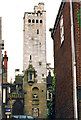
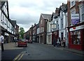
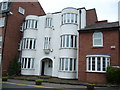
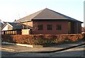
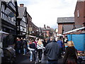
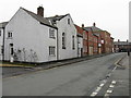
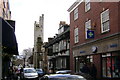
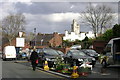
100 photos from this area
Area Information
Key information about the WA16 6AF including its size, population, and administrative classification.
- Area Type
- Postcode
- Area Size
- 3798 m²
- Population
- 1474
- Population Density
- 2252 people/km²
House Prices in WA16 6AF
5
Properties
£518,425
Average Sold Price
£364,000
Lowest Price
£672,850
Highest Price
Showing 5 properties
| Address | Type | Beds | Baths | Last Sale Price | Last Sale Date | |
|---|---|---|---|---|---|---|
| 16 Tatton Street, Knutsford, WA16 6AF | Semi-detached | 3 | 2 | £672,850 | Apr 2022 | |
| Woodlea, 18 Tatton Street, Knutsford, WA16 6AF | Semi-detached | 3 | - | £364,000 | Feb 2011 | |
| Knutsford Furniture Gallery, Tatton Street, Knutsford, WA16 6AF | undefined | - | - | - | - | |
| Second Floor, Edmundson House, Tatton Street, Knutsford, WA16 6AF | Office | - | - | - | - | |
| Edmonds House, Edmundson House, Tatton Street, Knutsford, WA16 6AF | office_workshop | - | - | - | - |
Energy Efficiency in WA16 6AF
Amenities
Schools
| Rank | School | Type | Entry gender | Ages |
|---|
Explore more schools in this area
Go to Schools tabDemographics
Household Size
One person
most common
Accommodation Type
Houses
most common
Tenure
56
majority
Ethnic Group
White
most common
Religion
N/A
most common
Household Composition
N/A
most common
Age
47
median
Adults (30-64 years)
most common
Household Deprivation
N/A
with no deprivation
NS-SEC
46
in Lower managerial occupations
Explore more demographic insights in this area
Go to Demographics tabPlanning
Planning Constraints
- Flood RiskPremium
- Ramsar Wetland SitesPremium
- Area of Outstanding Natural BeautyPremium
- Protected Nature ReservePremium
- Protected WoodlandPremium