Area Overview for WA16 0TE
Photos of WA16 0TE
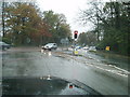
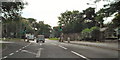
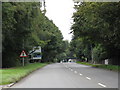
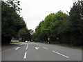

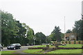
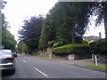

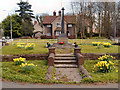

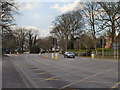
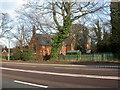
19 photos from this area
Area Information
Key information about the WA16 0TE including its size, population, and administrative classification.
- Area Type
- Postcode
- Area Size
- 9.2 hectares
- Population
- 2379
- Population Density
- 42 people/km²
House Prices in WA16 0TE
11
Properties
£1,387,000
Average Sold Price
£500,000
Lowest Price
£2,100,000
Highest Price
Showing 11 properties
| Address | Type | Beds | Baths | Last Sale Price | Last Sale Date | |
|---|---|---|---|---|---|---|
| Grasmere, Warrington Road, Mere, WA16 0TE | house | - | - | £1,300,000 | Apr 2024 | |
| Yew Trees, Warrington Road, Mere, WA16 0TE | house | - | - | £1,825,000 | Nov 2022 | |
| Juniper Hill, Warrington Road, Mere, WA16 0TE | Detached | 7 | 4 | £1,965,000 | Jun 2022 | |
| Lyndhurst, Warrington Road, Mere, WA16 0TE | house | - | - | £940,000 | Mar 2022 | |
| Sandilands, Warrington Road, Mere, WA16 0TE | Detached | 5 | - | £2,100,000 | Mar 2018 | |
| Parkgate House, Warrington Road, Mere, WA16 0TE | Detached | 6 | 5 | £1,975,000 | Oct 2017 | |
| Fir Tree Cottage, Warrington Road, Mere, WA16 0TE | Detached | 4 | - | £790,000 | Mar 2010 | |
| Westlins, Warrington Road, Mere, WA16 0TE | Detached | 6 | 5 | £1,062,500 | Aug 2009 | |
| Demere House, Warrington Road, Mere, WA16 0TE | house | - | - | £1,412,500 | Jul 2008 | |
| The Coppins, Warrington Road, Mere, WA16 0TE | Detached | 6 | 4 | £500,000 | Sep 2001 |
Page 1 of 2
Energy Efficiency in WA16 0TE
Amenities
Schools
| Rank | School | Type | Entry gender | Ages |
|---|
Explore more schools in this area
Go to Schools tabDemographics
Household Size
Two person
most common
Accommodation Type
Houses
most common
Tenure
62
majority
Ethnic Group
White
most common
Religion
N/A
most common
Household Composition
N/A
most common
Age
47
median
Adults (30-64 years)
most common
Household Deprivation
N/A
with no deprivation
NS-SEC
43
in Lower managerial occupations
Explore more demographic insights in this area
Go to Demographics tabPlanning
Planning Constraints
- Flood RiskPremium
- Ramsar Wetland SitesPremium
- Area of Outstanding Natural BeautyPremium
- Protected Nature ReservePremium
- Protected WoodlandPremium