Area Overview for WA15 8TR
Photos of WA15 8TR
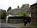

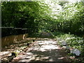
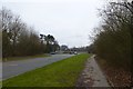

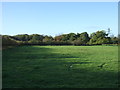

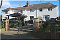
30 photos from this area
Area Information
Key information about the WA15 8TR including its size, population, and administrative classification.
- Area Type
- Postcode
- Area Size
- 35.9 hectares
- Population
- 1703
- Population Density
- 1343 people/km²
House Prices in WA15 8TR
21
Properties
£1,216,963
Average Sold Price
£370,000
Lowest Price
£2,740,000
Highest Price
Showing 21 properties
| Address | Type | Beds | Baths | Last Sale Price | Last Sale Date | |
|---|---|---|---|---|---|---|
| Dundrum, 42 Brooks Drive, Hale Barns, WA15 8TR | Detached | 5 | 1 | £2,740,000 | Nov 2024 | |
| Tregenna, 50 Brooks Drive, Hale Barns, WA15 8TR | house | 6 | - | £1,275,000 | Dec 2023 | |
| Marlborough, 40 Brooks Drive, Hale Barns, WA15 8TR | house | - | - | £1,200,000 | Feb 2021 | |
| Glaslough, 38 Brooks Drive, Hale Barns, WA15 8TR | Detached | 6 | 5 | £1,660,000 | Jan 2021 | |
| Willowmead, 46 Brooks Drive, Hale Barns, WA15 8TR | Detached | 7 | 4 | £1,325,000 | Apr 2019 | |
| Trees, 36 Brooks Drive, Hale Barns, WA15 8TR | house | - | - | £500,000 | Jul 2018 | |
| Beechwood, 44 Brooks Drive, Hale Barns, WA15 8TR | Detached | 5 | 5 | £2,550,000 | Mar 2018 | |
| Mayfield, 58 Brooks Drive, Hale Barns, WA15 8TR | Detached | 5 | - | £945,000 | Nov 2017 | |
| The Wood, 66 Brooks Drive, Hale Barns, WA15 8TR | Detached | 4 | - | £1,000,000 | Jul 2016 | |
| Silverheys, 52 Brooks Drive, Hale Barns, WA15 8TR | Detached | 5 | 6 | £960,000 | Jun 2007 |
Page 1 of 3
Energy Efficiency in WA15 8TR
Amenities
Schools
| Rank | School | Type | Entry gender | Ages |
|---|
Explore more schools in this area
Go to Schools tabDemographics
Household Size
Family (3-5 people)
most common
Accommodation Type
Houses
most common
Tenure
88
majority
Ethnic Group
White
most common
Religion
N/A
most common
Household Composition
N/A
most common
Age
47
median
Adults (30-64 years)
most common
Household Deprivation
N/A
with no deprivation
NS-SEC
55
in Lower managerial occupations
Explore more demographic insights in this area
Go to Demographics tabPlanning
Planning Constraints
- Flood RiskPremium
- Ramsar Wetland SitesPremium
- Area of Outstanding Natural BeautyPremium
- Protected Nature ReservePremium
- Protected WoodlandPremium