Area Overview for WA15 8DP
Photos of WA15 8DP
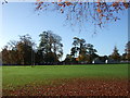

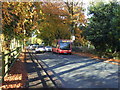
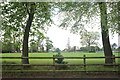
95 photos from this area
Area Information
Key information about the WA15 8DP including its size, population, and administrative classification.
- Area Type
- Postcode
- Area Size
- 2.6 hectares
- Population
- 1767
- Population Density
- 1953 people/km²
House Prices in WA15 8DP
24
Properties
£732,692
Average Sold Price
£465,000
Lowest Price
£970,000
Highest Price
Showing 24 properties
| Address | Type | Beds | Baths | Last Sale Price | Last Sale Date | |
|---|---|---|---|---|---|---|
| 34 Delahays Drive, Hale, WA15 8DP | Bungalow | 2 | 1 | £825,000 | Oct 2024 | |
| 6 Delahays Drive, Hale, WA15 8DP | Detached | 4 | 1 | £970,000 | Jun 2021 | |
| Outback, 18 Delahays Drive, Hale, WA15 8DP | Detached | 4 | 6 | £650,000 | Jul 2018 | |
| The Hamptons, 24 Delahays Drive, Hale, WA15 8DP | Detached | - | - | £775,000 | Feb 2017 | |
| 24 Delahays Drive, Hale, WA15 8DP | Detached | - | - | £775,000 | Feb 2017 | |
| 22 Delahays Drive, Hale, WA15 8DP | Detached | 4 | - | £835,000 | Dec 2014 | |
| 14 Delahays Drive, Hale, WA15 8DP | Bungalow | 3 | 2 | £675,000 | Apr 2014 | |
| 12 Delahays Drive, Hale, WA15 8DP | house | - | - | £850,000 | Dec 2009 | |
| 26A Delahays Drive, Hale, WA15 8DP | house | - | - | £825,000 | May 2007 | |
| 32 Delahays Drive, Hale, WA15 8DP | Detached | - | - | £700,000 | Nov 2006 |
Page 1 of 3
Energy Efficiency in WA15 8DP
Amenities
Schools
| Rank | School | Type | Entry gender | Ages |
|---|
Explore more schools in this area
Go to Schools tabDemographics
Household Size
Family (3-5 people)
most common
Accommodation Type
Houses
most common
Tenure
86
majority
Ethnic Group
White
most common
Religion
N/A
most common
Household Composition
N/A
most common
Age
47
median
Adults (30-64 years)
most common
Household Deprivation
N/A
with no deprivation
NS-SEC
52
in Lower managerial occupations
Explore more demographic insights in this area
Go to Demographics tabPlanning
Planning Constraints
- Flood RiskPremium
- Ramsar Wetland SitesPremium
- Area of Outstanding Natural BeautyPremium
- Protected Nature ReservePremium
- Protected WoodlandPremium