Area Overview for WA15 8AY
Photos of WA15 8AY
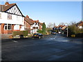
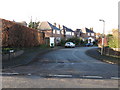

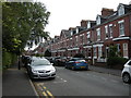
71 photos from this area
Area Information
Key information about the WA15 8AY including its size, population, and administrative classification.
- Area Type
- Postcode
- Area Size
- 1.0 hectares
- Population
- 1805
- Population Density
- 6222 people/km²
House Prices in WA15 8AY
31
Properties
£309,834
Average Sold Price
£84,950
Lowest Price
£678,000
Highest Price
Showing 31 properties
| Address | Type | Beds | Baths | Last Sale Price | Last Sale Date | |
|---|---|---|---|---|---|---|
| 3 Cleveland Road, Hale, WA15 8AY | Detached | 3 | 1 | £437,500 | Jul 2025 | |
| 21 Cleveland Road, Hale, WA15 8AY | Semi-detached | 4 | 2 | £678,000 | Mar 2024 | |
| 15 Cleveland Road, Hale, WA15 8AY | Semi-detached | 3 | 2 | £650,000 | Jan 2022 | |
| 26 Cleveland Road, Hale, WA15 8AY | house | - | - | £615,000 | May 2021 | |
| 22 Cleveland Road, Hale, WA15 8AY | house | 3 | 1 | £430,000 | Feb 2021 | |
| 8 Cleveland Road, Hale, WA15 8AY | Semi-detached | 3 | 1 | £437,000 | Sep 2019 | |
| 25 Cleveland Road, Hale, WA15 8AY | Terraced | 3 | 1 | £335,000 | Jul 2017 | |
| 34 Cleveland Road, Hale, WA15 8AY | Semi-detached | 5 | 2 | £488,000 | Dec 2014 | |
| 13 Cleveland Road, Hale, WA15 8AY | house | - | - | £299,950 | Aug 2010 | |
| 30 Cleveland Road, Hale, WA15 8AY | house | - | - | £285,000 | Jun 2010 |
Page 1 of 4
Energy Efficiency in WA15 8AY
Amenities
Schools
| Rank | School | Type | Entry gender | Ages |
|---|
Explore more schools in this area
Go to Schools tabDemographics
Household Size
Family (3-5 people)
most common
Accommodation Type
Houses
most common
Tenure
80
majority
Ethnic Group
White
most common
Religion
N/A
most common
Household Composition
N/A
most common
Age
47
median
Adults (30-64 years)
most common
Household Deprivation
N/A
with no deprivation
NS-SEC
58
in Lower managerial occupations
Explore more demographic insights in this area
Go to Demographics tabPlanning
Planning Constraints
- Flood RiskPremium
- Ramsar Wetland SitesPremium
- Area of Outstanding Natural BeautyPremium
- Protected Nature ReservePremium
- Protected WoodlandPremium