Area Overview for WA15 7AF
Photos of WA15 7AF
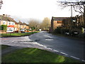
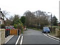
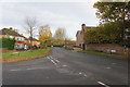

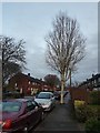
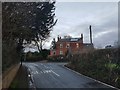


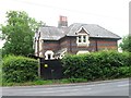

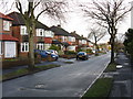
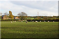
17 photos from this area
Area Information
Key information about the WA15 7AF including its size, population, and administrative classification.
- Area Type
- Postcode
- Area Size
- 10.2 hectares
- Population
- 1643
- Population Density
- 2173 people/km²
House Prices in WA15 7AF
12
Properties
£572,333
Average Sold Price
£519,500
Lowest Price
£640,000
Highest Price
Showing 12 properties
| Address | Type | Beds | Baths | Last Sale Price | Last Sale Date | |
|---|---|---|---|---|---|---|
| 39 Clay Lane, Timperley, WA15 7AF | Detached | 3 | 2 | £640,000 | Aug 2020 | |
| 29 Clay Lane, Timperley, WA15 7AF | Semi-detached | 4 | - | £557,500 | Aug 2012 | |
| Claycroft, 1 Clay Lane, Timperley, WA15 7AF | Land | - | - | £519,500 | May 2006 | |
| 31 Clay Lane, Timperley, WA15 7AF | Semi-detached | 4 | 2 | - | - | |
| Flat 1, British Airways Silverwings Sports Club, Clay Lane, Timperley, WA15 7AF | Flat | - | - | - | - | |
| 17 Clay Lane, Timperley, WA15 7AF | house | - | - | - | - | |
| Southfield Nursery, 27 Clay Lane, Timperley, WA15 7AF | Farm | - | - | - | - | |
| British Airways Club Flat, Clay Lane, Hale, WA15 7AF | Flat | - | - | - | - | |
| Tennis 38M From Hale Country Club, Clay Lane 20M From Unnamed Road, Fairfield Road, Timperley, WA15 7AF | Leisure | - | - | - | - | |
| Tennis 44M From Hale Country Club, Clay Lane 20M From Unnamed Road, Fairfield Road, Timperley, WA15 7AF | Leisure | - | - | - | - |
Page 1 of 2
Energy Efficiency in WA15 7AF
Amenities
Schools
| Rank | School | Type | Entry gender | Ages |
|---|
Explore more schools in this area
Go to Schools tabDemographics
Household Size
Family (3-5 people)
most common
Accommodation Type
Houses
most common
Tenure
93
majority
Ethnic Group
White
most common
Religion
N/A
most common
Household Composition
N/A
most common
Age
47
median
Adults (30-64 years)
most common
Household Deprivation
N/A
with no deprivation
NS-SEC
49
in Lower managerial occupations
Explore more demographic insights in this area
Go to Demographics tabPlanning
Planning Constraints
- Flood RiskPremium
- Ramsar Wetland SitesPremium
- Area of Outstanding Natural BeautyPremium
- Protected Nature ReservePremium
- Protected WoodlandPremium