Area Overview for WA15 6TG
Photos of WA15 6TG
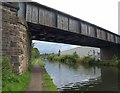


![Railway Bridge [no 32], from the south-west in WA15 6TG](https://images.propbar.co.uk/images/geograph/68/76/6876145_120.jpg)
52 photos from this area
Area Information
Key information about the WA15 6TG including its size, population, and administrative classification.
- Area Type
- Postcode
- Area Size
- 1.1 hectares
- Population
- 1687
- Population Density
- 4484 people/km²
House Prices in WA15 6TG
18
Properties
£389,627
Average Sold Price
£129,950
Lowest Price
£682,000
Highest Price
Showing 18 properties
| Address | Type | Beds | Baths | Last Sale Price | Last Sale Date | |
|---|---|---|---|---|---|---|
| 57 Park Road, Timperley, WA15 6TG | Semi-detached | 4 | 2 | £625,000 | Aug 2024 | |
| 59 Park Road, Timperley, WA15 6TG | Semi-detached | 4 | 2 | £565,000 | Apr 2024 | |
| 79 Park Road, Timperley, WA15 6TG | house | - | - | £682,000 | Jun 2021 | |
| 63 Park Road, Timperley, WA15 6TG | Semi-detached | 3 | - | £348,500 | Oct 2018 | |
| 67 Park Road, Timperley, WA15 6TG | house | - | - | £420,000 | Dec 2017 | |
| 81 Park Road, Timperley, WA15 6TG | Semi-detached | 4 | 1 | £557,500 | Jun 2017 | |
| 53 Park Road, Timperley, WA15 6TG | house | - | - | £345,000 | Jun 2016 | |
| 47 Park Road, Timperley, WA15 6TG | house | 3 | - | £209,700 | Jan 2012 | |
| 75 Park Road, Timperley, WA15 6TG | house | - | - | £290,000 | May 2010 | |
| 73 Park Road, Timperley, WA15 6TG | house | - | - | £325,000 | Aug 2009 |
Page 1 of 2
Energy Efficiency in WA15 6TG
Amenities
Schools
| Rank | School | Type | Entry gender | Ages |
|---|
Explore more schools in this area
Go to Schools tabDemographics
Household Size
Family (3-5 people)
most common
Accommodation Type
Houses
most common
Tenure
92
majority
Ethnic Group
White
most common
Religion
N/A
most common
Household Composition
N/A
most common
Age
47
median
Adults (30-64 years)
most common
Household Deprivation
N/A
with no deprivation
NS-SEC
52
in Lower managerial occupations
Explore more demographic insights in this area
Go to Demographics tabPlanning
Planning Constraints
- Flood RiskPremium
- Ramsar Wetland SitesPremium
- Area of Outstanding Natural BeautyPremium
- Protected Nature ReservePremium
- Protected WoodlandPremium