Area Overview for WA15 6SG
Photos of WA15 6SG
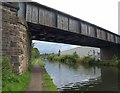

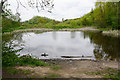


![Railway Bridge [no 32], from the south-west in WA15 6SG](https://images.propbar.co.uk/images/geograph/68/76/6876145_120.jpg)
52 photos from this area
Area Information
Key information about the WA15 6SG including its size, population, and administrative classification.
- Area Type
- Postcode
- Area Size
- 1.1 hectares
- Population
- 2300
- Population Density
- 5664 people/km²
House Prices in WA15 6SG
52
Properties
£235,991
Average Sold Price
£76,000
Lowest Price
£428,000
Highest Price
Showing 52 properties
| Address | Type | Beds | Baths | Last Sale Price | Last Sale Date | |
|---|---|---|---|---|---|---|
| 10 St Andrews Avenue, Timperley, WA15 6SG | house | - | - | £316,300 | Aug 2025 | |
| 27 St Andrews Avenue, Timperley, WA15 6SG | house | - | - | £320,000 | Mar 2025 | |
| 3 St Andrews Avenue, Timperley, WA15 6SG | Terraced | 3 | 1 | £428,000 | Mar 2025 | |
| 22 St Andrews Avenue, Timperley, WA15 6SG | Terraced | 2 | 1 | £290,000 | Mar 2025 | |
| 30 St Andrews Avenue, Timperley, WA15 6SG | Terraced | 2 | 1 | £310,000 | Sep 2024 | |
| 9 St Andrews Avenue, Timperley, WA15 6SG | Terraced | 2 | 1 | £320,000 | Oct 2023 | |
| 17 St Andrews Avenue, Timperley, WA15 6SG | Terraced | 2 | 1 | £350,000 | Jun 2023 | |
| 24 St Andrews Avenue, Timperley, WA15 6SG | house | 2 | 2 | £305,000 | Jan 2023 | |
| 14 St Andrews Avenue, Timperley, WA15 6SG | house | - | - | £323,000 | Nov 2022 | |
| 25 St Andrews Avenue, Timperley, WA15 6SG | house | 2 | 1 | £312,500 | Mar 2022 |
Page 1 of 6
Energy Efficiency in WA15 6SG
Amenities
Schools
| Rank | School | Type | Entry gender | Ages |
|---|
Explore more schools in this area
Go to Schools tabDemographics
Household Size
Two person
most common
Accommodation Type
Houses
most common
Tenure
67
majority
Ethnic Group
White
most common
Religion
N/A
most common
Household Composition
N/A
most common
Age
47
median
Adults (30-64 years)
most common
Household Deprivation
N/A
with no deprivation
NS-SEC
45
in Lower managerial occupations
Explore more demographic insights in this area
Go to Demographics tabPlanning
Planning Constraints
- Flood RiskPremium
- Ramsar Wetland SitesPremium
- Area of Outstanding Natural BeautyPremium
- Protected Nature ReservePremium
- Protected WoodlandPremium