Area Overview for WA15 0NA
Photos of WA15 0NA
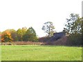
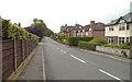
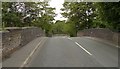
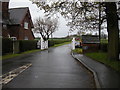
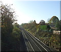
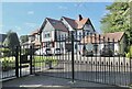
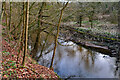
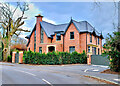
35 photos from this area
Area Information
Key information about the WA15 0NA including its size, population, and administrative classification.
- Area Type
- Postcode
- Area Size
- 1.4 hectares
- Population
- 1493
- Population Density
- 1271 people/km²
House Prices in WA15 0NA
20
Properties
£756,925
Average Sold Price
£316,500
Lowest Price
£1,235,000
Highest Price
Showing 20 properties
| Address | Type | Beds | Baths | Last Sale Price | Last Sale Date | |
|---|---|---|---|---|---|---|
| 10 Arthog Road, Hale Barns, WA15 0NA | house | - | - | £1,125,000 | Dec 2023 | |
| 9 Arthog Road, Hale Barns, WA15 0NA | house | - | - | £827,500 | Feb 2023 | |
| 11 Arthog Road, Hale Barns, WA15 0NA | house | - | - | £890,000 | Jan 2023 | |
| 1 Arthog Road, Hale Barns, WA15 0NA | house | - | - | £914,300 | Jun 2021 | |
| 8 Arthog Road, Hale Barns, WA15 0NA | house | - | - | £860,000 | Mar 2021 | |
| 3 Arthog Road, Hale Barns, WA15 0NA | Semi-detached | 5 | - | £780,000 | Apr 2019 | |
| 13 Arthog Road, Hale Barns, WA15 0NA | Semi-detached | 4 | - | £975,000 | Oct 2018 | |
| Marlton House, 17 Arthog Road, Hale Barns, WA15 0NA | house | - | - | £1,235,000 | Feb 2018 | |
| Ardlienne, 2A Arthog Road, Hale Barns, WA15 0NA | Detached | 3 | 2 | £620,000 | Nov 2014 | |
| 6 Arthog Road, Hale Barns, WA15 0NA | house | - | - | £717,500 | Apr 2014 |
Page 1 of 2
Energy Efficiency in WA15 0NA
Amenities
Schools
| Rank | School | Type | Entry gender | Ages |
|---|
Explore more schools in this area
Go to Schools tabDemographics
Household Size
Family (3-5 people)
most common
Accommodation Type
Houses
most common
Tenure
93
majority
Ethnic Group
White
most common
Religion
N/A
most common
Household Composition
N/A
most common
Age
47
median
Adults (30-64 years)
most common
Household Deprivation
N/A
with no deprivation
NS-SEC
55
in Lower managerial occupations
Explore more demographic insights in this area
Go to Demographics tabPlanning
Planning Constraints
- Flood RiskPremium
- Ramsar Wetland SitesPremium
- Area of Outstanding Natural BeautyPremium
- Protected Nature ReservePremium
- Protected WoodlandPremium