Area Overview for WA15 0HJ
Photos of WA15 0HJ
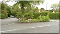
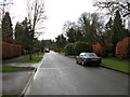
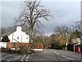
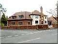
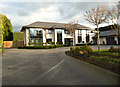
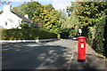
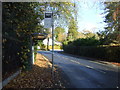
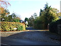
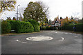
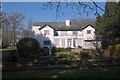
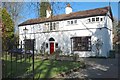
100 photos from this area
Area Information
Key information about the WA15 0HJ including its size, population, and administrative classification.
- Area Type
- Postcode
- Area Size
- 1.9 hectares
- Population
- 1703
- Population Density
- 1343 people/km²
House Prices in WA15 0HJ
12
Properties
£1,596,231
Average Sold Price
£388,616
Lowest Price
£3,650,000
Highest Price
Showing 12 properties
| Address | Type | Beds | Baths | Last Sale Price | Last Sale Date | |
|---|---|---|---|---|---|---|
| 10 Chapel Lane, Hale Barns, WA15 0HJ | Detached | 5 | 5 | £1,110,000 | Mar 2023 | |
| The Oakfield, 20 Chapel Lane, Hale Barns, WA15 0HJ | Detached | 6 | 5 | £2,549,999 | Oct 2020 | |
| Broadoak House, 22 Chapel Lane, Hale Barns, WA15 0HJ | Detached | 5 | 5 | £1,800,000 | Feb 2019 | |
| 14 Chapel Lane, Hale Barns, WA15 0HJ | Detached | 6 | 6 | £3,650,000 | Sep 2013 | |
| 12 Chapel Lane, Hale Barns, WA15 0HJ | Detached | 5 | 5 | £1,175,000 | Jul 2006 | |
| 1A Chapel Lane, Hale Barns, WA15 0HJ | Detached | - | - | £499,999 | Aug 2005 | |
| 1 Chapel Lane, Hale Barns, WA15 0HJ | Detached | - | - | £388,616 | Jul 2002 | |
| Wicker Hall, 2 Chapel Lane, Hale Barns, WA15 0HJ | Retail | 5 | 2 | - | - | |
| Site Of 20, Chapel Lane, Hale Barns, WA15 0HJ | Detached | - | - | - | - | |
| 5 Chapel Lane, Hale Barns, WA15 0HJ | Semi-detached | - | - | - | - |
Page 1 of 2
Energy Efficiency in WA15 0HJ
Amenities
Schools
| Rank | School | Type | Entry gender | Ages |
|---|
Explore more schools in this area
Go to Schools tabDemographics
Household Size
Family (3-5 people)
most common
Accommodation Type
Houses
most common
Tenure
88
majority
Ethnic Group
White
most common
Religion
N/A
most common
Household Composition
N/A
most common
Age
47
median
Adults (30-64 years)
most common
Household Deprivation
N/A
with no deprivation
NS-SEC
55
in Lower managerial occupations
Explore more demographic insights in this area
Go to Demographics tabPlanning
Planning Constraints
- Flood RiskPremium
- Ramsar Wetland SitesPremium
- Area of Outstanding Natural BeautyPremium
- Protected Nature ReservePremium
- Protected WoodlandPremium