Area Overview for WA15 0EP
Photos of WA15 0EP
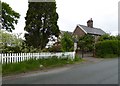
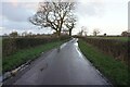
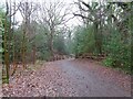
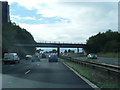
16 photos from this area
Area Information
Key information about the WA15 0EP including its size, population, and administrative classification.
- Area Type
- Postcode
- Area Size
- 8.8 hectares
- Population
- 1421
- Population Density
- 1038 people/km²
House Prices in WA15 0EP
10
Properties
£890,000
Average Sold Price
£490,000
Lowest Price
£1,200,000
Highest Price
Showing 10 properties
| Address | Type | Beds | Baths | Last Sale Price | Last Sale Date | |
|---|---|---|---|---|---|---|
| 66 Carrwood, Hale Barns, WA15 0EP | Detached | 4 | 1 | £1,200,000 | Feb 2021 | |
| 72 Carrwood, Hale Barns, WA15 0EP | house | - | - | £950,000 | Jul 2018 | |
| Wood Dene, 70 Carrwood, Hale Barns, WA15 0EP | Detached | 4 | - | £1,075,000 | Feb 2016 | |
| 74 Carrwood, Hale Barns, WA15 0EP | Detached | 4 | - | £1,050,000 | Feb 2014 | |
| 60 Carrwood, Hale Barns, WA15 0EP | Detached | 5 | 5 | £825,000 | Oct 2002 | |
| 68 Carrwood, Hale Barns, WA15 0EP | Detached | - | - | £640,000 | Aug 2001 | |
| 58 Carrwood, Hale Barns, WA15 0EP | house | - | - | £490,000 | Dec 1999 | |
| 62 Carrwood, Hale Barns, WA15 0EP | Detached | - | - | - | - | |
| Green Acre, 56 Carrwood, Hale Barns, WA15 0EP | Detached | - | - | - | - | |
| 64 Carrwood, Hale Barns, WA15 0EP | Detached | - | - | - | - |
Energy Efficiency in WA15 0EP
Amenities
Schools
| Rank | School | Type | Entry gender | Ages |
|---|
Explore more schools in this area
Go to Schools tabDemographics
Household Size
Family (3-5 people)
most common
Accommodation Type
Houses
most common
Tenure
88
majority
Ethnic Group
White
most common
Religion
N/A
most common
Household Composition
N/A
most common
Age
47
median
Adults (30-64 years)
most common
Household Deprivation
N/A
with no deprivation
NS-SEC
53
in Lower managerial occupations
Explore more demographic insights in this area
Go to Demographics tabPlanning
Planning Constraints
- Flood RiskPremium
- Ramsar Wetland SitesPremium
- Area of Outstanding Natural BeautyPremium
- Protected Nature ReservePremium
- Protected WoodlandPremium