Area Overview for WA14 5ZN
Photos of WA14 5ZN
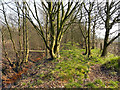
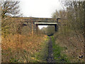


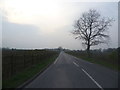
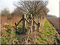
11 photos from this area
Area Information
Key information about the WA14 5ZN including its size, population, and administrative classification.
- Area Type
- Postcode
- Area Size
- 8749 m²
- Population
- 2970
- Population Density
- 4286 people/km²
House Prices in WA14 5ZN
30
Properties
£293,484
Average Sold Price
£128,245
Lowest Price
£530,000
Highest Price
Showing 30 properties
| Address | Type | Beds | Baths | Last Sale Price | Last Sale Date | |
|---|---|---|---|---|---|---|
| 25 Over Ashberry, Altrincham, WA14 5ZN | Semi-detached | 3 | 2 | £440,000 | Jul 2024 | |
| 14 Over Ashberry, Altrincham, WA14 5ZN | house | - | - | £530,000 | Aug 2022 | |
| 33 Over Ashberry, Altrincham, WA14 5ZN | house | 2 | 1 | £252,000 | Jul 2021 | |
| 3 Over Ashberry, Altrincham, WA14 5ZN | house | - | - | £445,000 | May 2021 | |
| 16 Over Ashberry, Altrincham, WA14 5ZN | house | 4 | 2 | £356,000 | Mar 2021 | |
| 19 Over Ashberry, Altrincham, WA14 5ZN | Detached | 4 | 2 | £428,000 | Aug 2020 | |
| 27 Over Ashberry, Altrincham, WA14 5ZN | house | - | - | £342,000 | Mar 2019 | |
| 5 Over Ashberry, Altrincham, WA14 5ZN | house | - | - | £430,000 | Jul 2017 | |
| 22 Over Ashberry, Altrincham, WA14 5ZN | house | - | - | £305,000 | Apr 2017 | |
| 2 Over Ashberry, Altrincham, WA14 5ZN | Semi-detached | 3 | - | £275,000 | Mar 2016 |
Page 1 of 3
Energy Efficiency in WA14 5ZN
Amenities
Schools
| Rank | School | Type | Entry gender | Ages |
|---|
Explore more schools in this area
Go to Schools tabDemographics
Household Size
Family (3-5 people)
most common
Accommodation Type
Houses
most common
Tenure
75
majority
Ethnic Group
White
most common
Religion
N/A
most common
Household Composition
N/A
most common
Age
47
median
Adults (30-64 years)
most common
Household Deprivation
N/A
with no deprivation
NS-SEC
47
in Lower managerial occupations
Explore more demographic insights in this area
Go to Demographics tabPlanning
Planning Constraints
- Flood RiskPremium
- Ramsar Wetland SitesPremium
- Area of Outstanding Natural BeautyPremium
- Protected Nature ReservePremium
- Protected WoodlandPremium