Area Overview for WA14 5XR
Photos of WA14 5XR
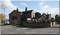
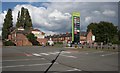

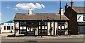
53 photos from this area
Area Information
Key information about the WA14 5XR including its size, population, and administrative classification.
- Area Type
- Postcode
- Area Size
- 6011 m²
- Population
- 1659
- Population Density
- 1474 people/km²
House Prices in WA14 5XR
21
Properties
£534,823
Average Sold Price
£160,000
Lowest Price
£3,902,021
Highest Price
Showing 21 properties
| Address | Type | Beds | Baths | Last Sale Price | Last Sale Date | |
|---|---|---|---|---|---|---|
| 1 Huntspill Road, Altrincham, WA14 5XR | Semi-detached | 3 | 2 | £325,000 | Feb 2024 | |
| 7 Huntspill Road, Altrincham, WA14 5XR | Terraced | - | - | £340,000 | Aug 2021 | |
| 2 Huntspill Road, Altrincham, WA14 5XR | Semi-detached | 3 | 2 | £270,000 | Sep 2018 | |
| 3 Huntspill Road, Altrincham, WA14 5XR | Flat | 2 | 1 | £160,000 | Oct 2017 | |
| 10 Huntspill Road, Altrincham, WA14 5XR | Flat | - | - | £170,000 | Jul 2015 | |
| 9 Huntspill Road, Altrincham, WA14 5XR | Flat | 2 | 1 | £199,500 | Apr 2015 | |
| 11 Huntspill Road, Altrincham, WA14 5XR | Flat | - | - | £3,902,021 | Dec 2014 | |
| 15 Huntspill Road, Altrincham, WA14 5XR | Flat | - | - | £169,950 | Jun 2008 | |
| 5 Huntspill Road, Altrincham, WA14 5XR | Terraced | 3 | - | £229,000 | Jan 2008 | |
| 4 Huntspill Road, Altrincham, WA14 5XR | Semi-detached | 3 | 2 | £221,400 | Dec 2006 |
Page 1 of 3
Energy Efficiency in WA14 5XR
Amenities
Schools
| Rank | School | Type | Entry gender | Ages |
|---|
Explore more schools in this area
Go to Schools tabDemographics
Household Size
Family (3-5 people)
most common
Accommodation Type
Houses
most common
Tenure
90
majority
Ethnic Group
White
most common
Religion
N/A
most common
Household Composition
N/A
most common
Age
47
median
Adults (30-64 years)
most common
Household Deprivation
N/A
with no deprivation
NS-SEC
47
in Lower managerial occupations
Explore more demographic insights in this area
Go to Demographics tabPlanning
Planning Constraints
- Flood RiskPremium
- Ramsar Wetland SitesPremium
- Area of Outstanding Natural BeautyPremium
- Protected Nature ReservePremium
- Protected WoodlandPremium