Area Overview for WA14 5JB
Photos of WA14 5JB
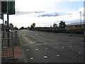
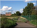
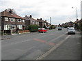
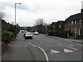
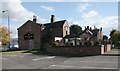
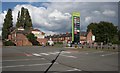

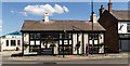
53 photos from this area
Area Information
Key information about the WA14 5JB including its size, population, and administrative classification.
- Area Type
- Postcode
- Area Size
- 1.6 hectares
- Population
- 1331
- Population Density
- 2337 people/km²
House Prices in WA14 5JB
50
Properties
£199,258
Average Sold Price
£38,500
Lowest Price
£353,000
Highest Price
Showing 50 properties
| Address | Type | Beds | Baths | Last Sale Price | Last Sale Date | |
|---|---|---|---|---|---|---|
| 9 Woodstock Road, Altrincham, WA14 5JB | Terraced | 3 | 1 | £353,000 | Nov 2024 | |
| 42 Woodstock Road, Altrincham, WA14 5JB | Terraced | 3 | 1 | £280,000 | Oct 2024 | |
| 38 Woodstock Road, Altrincham, WA14 5JB | Terraced | 3 | 2 | £325,000 | Sep 2024 | |
| 56 Woodstock Road, Altrincham, WA14 5JB | Semi-detached | 3 | 1 | £322,000 | Aug 2023 | |
| 34 Woodstock Road, Altrincham, WA14 5JB | house | - | - | £285,000 | Apr 2022 | |
| 17 Woodstock Road, Altrincham, WA14 5JB | house | - | - | £280,000 | Nov 2021 | |
| 48 Woodstock Road, Altrincham, WA14 5JB | house | - | - | £285,000 | Jun 2021 | |
| 39 Woodstock Road, Altrincham, WA14 5JB | house | - | - | £209,000 | Jun 2021 | |
| 30 Woodstock Road, Altrincham, WA14 5JB | Terraced | 3 | 1 | £290,000 | Dec 2019 | |
| 52 Woodstock Road, Altrincham, WA14 5JB | Terraced | 3 | 1 | £215,000 | Aug 2019 |
Page 1 of 5
Energy Efficiency in WA14 5JB
Amenities
Schools
| Rank | School | Type | Entry gender | Ages |
|---|
Explore more schools in this area
Go to Schools tabDemographics
Household Size
Family (3-5 people)
most common
Accommodation Type
Houses
most common
Tenure
42
majority
Ethnic Group
White
most common
Religion
N/A
most common
Household Composition
N/A
most common
Age
47
median
Adults (30-64 years)
most common
Household Deprivation
N/A
with no deprivation
NS-SEC
26
in Lower managerial occupations
Explore more demographic insights in this area
Go to Demographics tabPlanning
Planning Constraints
- Flood RiskPremium
- Ramsar Wetland SitesPremium
- Area of Outstanding Natural BeautyPremium
- Protected Nature ReservePremium
- Protected WoodlandPremium