Area Overview for WA14 5HZ
Photos of WA14 5HZ
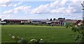
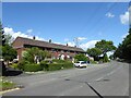
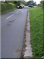
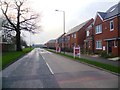
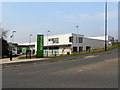
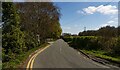
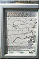
12 photos from this area
Area Information
Key information about the WA14 5HZ including its size, population, and administrative classification.
- Area Type
- Postcode
- Area Size
- 9223 m²
- Population
- 2970
- Population Density
- 4286 people/km²
House Prices in WA14 5HZ
28
Properties
£182,569
Average Sold Price
£51,000
Lowest Price
£525,000
Highest Price
Showing 28 properties
| Address | Type | Beds | Baths | Last Sale Price | Last Sale Date | |
|---|---|---|---|---|---|---|
| 388 Barlow Road, Altrincham, WA14 5HZ | Semi-detached | 3 | 1 | £250,000 | Mar 2025 | |
| 403 Barlow Road, Altrincham, WA14 5HZ | Semi-detached | 4 | 1 | £375,000 | Jun 2021 | |
| 409 Barlow Road, Altrincham, WA14 5HZ | Detached | 4 | 3 | £525,000 | Nov 2020 | |
| 420 Barlow Road, Altrincham, WA14 5HZ | house | 3 | 1 | £225,000 | May 2018 | |
| 404 Barlow Road, Altrincham, WA14 5HZ | Semi-detached | - | - | £138,000 | Jan 2018 | |
| 410 Barlow Road, Altrincham, WA14 5HZ | house | 3 | - | £200,000 | May 2016 | |
| 411 Barlow Road, Altrincham, WA14 5HZ | house | - | - | £249,999 | Aug 2013 | |
| 415 Barlow Road, Altrincham, WA14 5HZ | house | - | - | £218,250 | Apr 2013 | |
| 413 Barlow Road, Altrincham, WA14 5HZ | house | - | - | £225,000 | Apr 2013 | |
| 392 Barlow Road, Altrincham, WA14 5HZ | house | 2 | - | £141,500 | Aug 2012 |
Page 1 of 3
Energy Efficiency in WA14 5HZ
Amenities
Schools
| Rank | School | Type | Entry gender | Ages |
|---|
Explore more schools in this area
Go to Schools tabDemographics
Household Size
Family (3-5 people)
most common
Accommodation Type
Houses
most common
Tenure
75
majority
Ethnic Group
White
most common
Religion
N/A
most common
Household Composition
N/A
most common
Age
47
median
Adults (30-64 years)
most common
Household Deprivation
N/A
with no deprivation
NS-SEC
47
in Lower managerial occupations
Explore more demographic insights in this area
Go to Demographics tabPlanning
Planning Constraints
- Flood RiskPremium
- Ramsar Wetland SitesPremium
- Area of Outstanding Natural BeautyPremium
- Protected Nature ReservePremium
- Protected WoodlandPremium