Area Overview for WA14 4QH
Photos of WA14 4QH
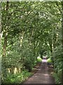
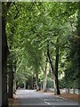
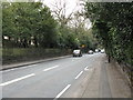
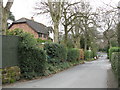

60 photos from this area
Area Information
Key information about the WA14 4QH including its size, population, and administrative classification.
- Area Type
- Postcode
- Area Size
- 6995 m²
- Population
- 1675
- Population Density
- 2641 people/km²
House Prices in WA14 4QH
8
Properties
£433,375
Average Sold Price
£331,000
Lowest Price
£621,000
Highest Price
Showing 8 properties
| Address | Type | Beds | Baths | Last Sale Price | Last Sale Date | |
|---|---|---|---|---|---|---|
| 4 Glenfield, Altrincham, WA14 4QH | Semi-detached | 4 | 2 | £621,000 | Apr 2023 | |
| 8 Glenfield, Altrincham, WA14 4QH | house | 5 | 2 | £550,000 | Sep 2022 | |
| 5 Glenfield, Altrincham, WA14 4QH | Semi-detached | 4 | - | £475,000 | Jun 2020 | |
| 2 Glenfield, Altrincham, WA14 4QH | house | - | - | £445,000 | Jun 2019 | |
| 6 Glenfield, Altrincham, WA14 4QH | Semi-detached | 4 | 2 | £350,000 | Feb 2015 | |
| 3 Glenfield, Altrincham, WA14 4QH | Terraced | 4 | 2 | £360,000 | Jul 2014 | |
| 7 Glenfield, Altrincham, WA14 4QH | house | 4 | - | £331,000 | Dec 2012 | |
| 1 Glenfield, Altrincham, WA14 4QH | Semi-detached | 5 | 2 | £335,000 | Apr 2007 |
Energy Efficiency in WA14 4QH
Amenities
Schools
| Rank | School | Type | Entry gender | Ages |
|---|
Explore more schools in this area
Go to Schools tabDemographics
Household Size
One person
most common
Accommodation Type
Flats
most common
Tenure
76
majority
Ethnic Group
White
most common
Religion
N/A
most common
Household Composition
N/A
most common
Age
47
median
Adults (30-64 years)
most common
Household Deprivation
N/A
with no deprivation
NS-SEC
54
in Lower managerial occupations
Explore more demographic insights in this area
Go to Demographics tabPlanning
Planning Constraints
- Flood RiskPremium
- Ramsar Wetland SitesPremium
- Area of Outstanding Natural BeautyPremium
- Protected Nature ReservePremium
- Protected WoodlandPremium