Area Overview for WA14 4JB
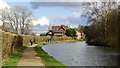
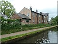
Photos of WA14 4JB

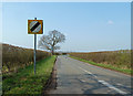
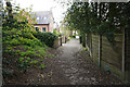
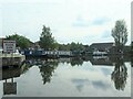
![Seamon's Moss Bridge [no 29], from the east in WA14 4JB](https://images.propbar.co.uk/images/geograph/68/75/6875424_120.jpg)
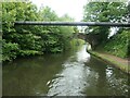
33 photos from this area
Area Information
Key information about the WA14 4JB including its size, population, and administrative classification.
- Area Type
- Postcode
- Area Size
- 1.8 hectares
- Population
- 1643
- Population Density
- 1448 people/km²
House Prices in WA14 4JB
58
Properties
£267,952
Average Sold Price
£54,000
Lowest Price
£550,000
Highest Price
Showing 58 properties
| Address | Type | Beds | Baths | Last Sale Price | Last Sale Date | |
|---|---|---|---|---|---|---|
| 4 St Marks Avenue, Altrincham, WA14 4JB | house | 3 | 1 | £550,000 | Jul 2025 | |
| 39 St Marks Avenue, Altrincham, WA14 4JB | Semi-detached | 3 | 1 | £462,239 | Feb 2025 | |
| 41 St Marks Avenue, Altrincham, WA14 4JB | Semi-detached | 3 | 1 | £440,000 | Jun 2024 | |
| 37 St Marks Avenue, Altrincham, WA14 4JB | house | - | - | £475,000 | Nov 2022 | |
| 5 St Marks Avenue, Altrincham, WA14 4JB | house | - | - | £433,500 | Jan 2021 | |
| 7 St Marks Avenue, Altrincham, WA14 4JB | Semi-detached | 3 | 1 | £455,000 | Aug 2020 | |
| 8 St Marks Avenue, Altrincham, WA14 4JB | Semi-detached | 3 | 1 | £370,000 | Aug 2019 | |
| 25 St Marks Avenue, Altrincham, WA14 4JB | house | - | - | £380,000 | May 2019 | |
| 18 St Marks Avenue, Altrincham, WA14 4JB | house | - | - | £358,500 | Jan 2019 | |
| 29 St Marks Avenue, Altrincham, WA14 4JB | Semi-detached | 4 | - | £490,000 | Sep 2017 |
Page 1 of 6
Energy Efficiency in WA14 4JB
Amenities
Schools
| Rank | School | Type | Entry gender | Ages |
|---|
Explore more schools in this area
Go to Schools tabDemographics
Household Size
Family (3-5 people)
most common
Accommodation Type
Houses
most common
Tenure
60
majority
Ethnic Group
White
most common
Religion
N/A
most common
Household Composition
N/A
most common
Age
47
median
Adults (30-64 years)
most common
Household Deprivation
N/A
with no deprivation
NS-SEC
40
in Lower managerial occupations
Explore more demographic insights in this area
Go to Demographics tabPlanning
Planning Constraints
- Flood RiskPremium
- Ramsar Wetland SitesPremium
- Area of Outstanding Natural BeautyPremium
- Protected Nature ReservePremium
- Protected WoodlandPremium