Area Overview for WA14 3JU
Photos of WA14 3JU

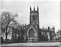
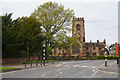

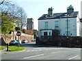
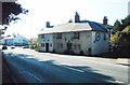
43 photos from this area
Area Information
Key information about the WA14 3JU including its size, population, and administrative classification.
- Area Type
- Postcode
- Area Size
- 1.8 hectares
- Population
- 1452
- Population Density
- 78 people/km²
House Prices in WA14 3JU
10
Properties
£1,161,667
Average Sold Price
£215,000
Lowest Price
£3,000,000
Highest Price
Showing 10 properties
| Address | Type | Beds | Baths | Last Sale Price | Last Sale Date | |
|---|---|---|---|---|---|---|
| 41 Stanhope Road, Bowdon, WA14 3JU | Detached | 6 | 5 | £3,000,000 | Mar 2022 | |
| 31 Stanhope Road, Bowdon, WA14 3JU | Detached | 4 | - | £1,120,000 | Jul 2015 | |
| 43 Stanhope Road, Bowdon, WA14 3JU | house | - | - | £1,240,000 | Nov 2010 | |
| 39 Stanhope Road, Bowdon, WA14 3JU | house | - | - | £900,000 | Jan 2010 | |
| 45 Stanhope Road, Bowdon, WA14 3JU | Detached | 6 | - | £495,000 | Dec 2002 | |
| 31A Stanhope Road, Bowdon, WA14 3JU | Detached | - | - | £215,000 | Jun 1996 | |
| Windrift, 33 Stanhope Road, Bowdon, WA14 3JU | Detached | - | - | - | - | |
| 37 Stanhope Road, Bowdon, WA14 3JU | Detached | - | - | - | - | |
| 29 Stanhope Road, Bowdon, WA14 3JU | Detached | - | - | - | - | |
| 35 Stanhope Road, Bowdon, WA14 3JU | house | - | - | - | - |
Energy Efficiency in WA14 3JU
Amenities
Schools
| Rank | School | Type | Entry gender | Ages |
|---|
Explore more schools in this area
Go to Schools tabDemographics
Household Size
Two person
most common
Accommodation Type
Houses
most common
Tenure
73
majority
Ethnic Group
White
most common
Religion
N/A
most common
Household Composition
N/A
most common
Age
47
median
Adults (30-64 years)
most common
Household Deprivation
N/A
with no deprivation
NS-SEC
51
in Lower managerial occupations
Explore more demographic insights in this area
Go to Demographics tabPlanning
Planning Constraints
- Flood RiskPremium
- Ramsar Wetland SitesPremium
- Area of Outstanding Natural BeautyPremium
- Protected Nature ReservePremium
- Protected WoodlandPremium