Area Overview for WA14 2PG
Photos of WA14 2PG
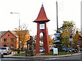
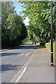
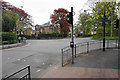
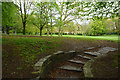

100 photos from this area
Area Information
Key information about the WA14 2PG including its size, population, and administrative classification.
- Area Type
- Postcode
- Area Size
- 1.1 hectares
- Population
- 1498
- Population Density
- 1696 people/km²
House Prices in WA14 2PG
9
Properties
£1,796,667
Average Sold Price
£790,000
Lowest Price
£2,975,000
Highest Price
Showing 9 properties
| Address | Type | Beds | Baths | Last Sale Price | Last Sale Date | |
|---|---|---|---|---|---|---|
| 4 Winton Road, Bowdon, WA14 2PG | Detached | 5 | - | £1,625,000 | Jun 2021 | |
| 2 Winton Road, Bowdon, WA14 2PG | Detached | 5 | - | £2,975,000 | Jul 2018 | |
| 6 Winton Road, Bowdon, WA14 2PG | house | - | - | £790,000 | Dec 2004 | |
| The Clubhouse, Winton Road, Bowdon, WA14 2PG | Leisure | - | - | - | - | |
| Tennis 17M From Bowdon Bowling & Lawn Tennis Club Ltd, Winton Road 17M From Unnamed Road, Winton Road, Bowdon, WA14 2PG | Leisure | - | - | - | - | |
| Tennis 21M From Bowdon Bowling & Lawn Tennis Club Ltd, Winton Road 15M From Unnamed Road, Birchdale, Bowdon, WA14 2PG | Leisure | - | - | - | - | |
| Tennis 45M From Rosemede, St Marys Road 12M From Unnamed Road, Winton Road, Bowdon, WA14 2PG | Leisure | - | - | - | - | |
| Tennis 39M From Bowdon Bowling & Lawn Tennis Club Ltd, Winton Road 18M From Unnamed Road, Winton Road, Bowdon, WA14 2PG | Leisure | - | - | - | - | |
| Chellercroft, 1 Winton Road, Bowdon, WA14 2PG | Detached | - | - | - | - |
Energy Efficiency in WA14 2PG
Amenities
Schools
| Rank | School | Type | Entry gender | Ages |
|---|
Explore more schools in this area
Go to Schools tabDemographics
Household Size
Two person
most common
Accommodation Type
Houses
most common
Tenure
81
majority
Ethnic Group
White
most common
Religion
N/A
most common
Household Composition
N/A
most common
Age
47
median
Adults (30-64 years)
most common
Household Deprivation
N/A
with no deprivation
NS-SEC
60
in Lower managerial occupations
Explore more demographic insights in this area
Go to Demographics tabPlanning
Planning Constraints
- Flood RiskPremium
- Ramsar Wetland SitesPremium
- Area of Outstanding Natural BeautyPremium
- Protected Nature ReservePremium
- Protected WoodlandPremium