Area Overview for WA13 9HU
Photos of WA13 9HU
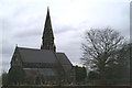

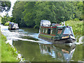
![Boats moored east of Lloyd Bridge [no 24] in WA13 9HU](https://images.propbar.co.uk/images/geograph/68/75/6875703_120.jpg)
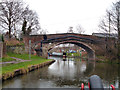
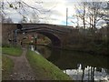
![Lloyd Bridge [no 24], from the east in WA13 9HU](https://images.propbar.co.uk/images/geograph/68/75/6875707_120.jpg)

33 photos from this area
Area Information
Key information about the WA13 9HU including its size, population, and administrative classification.
- Area Type
- Postcode
- Area Size
- 2.6 hectares
- Population
- 2125
- Population Density
- 388 people/km²
House Prices in WA13 9HU
37
Properties
£207,900
Average Sold Price
£125,000
Lowest Price
£465,000
Highest Price
Showing 37 properties
| Address | Type | Beds | Baths | Last Sale Price | Last Sale Date | |
|---|---|---|---|---|---|---|
| 42 Hopefield Road, Lymm, Warrington, WA13 9HU | Semi-detached | 3 | 3 | £465,000 | Jan 2025 | |
| 36 Hopefield Road, Lymm, Warrington, WA13 9HU | Terraced | 2 | 1 | £225,000 | May 2022 | |
| 19 Hopefield Road, Lymm, Warrington, WA13 9HU | house | - | - | £220,000 | Sep 2021 | |
| 40 Hopefield Road, Lymm, Warrington, WA13 9HU | Terraced | 2 | 1 | £205,000 | Feb 2021 | |
| 23 Hopefield Road, Lymm, Warrington, WA13 9HU | house | - | - | £210,000 | Jan 2021 | |
| 6 Hopefield Road, Lymm, Warrington, WA13 9HU | house | - | - | £222,500 | Jan 2021 | |
| 52 Hopefield Road, Lymm, Warrington, WA13 9HU | house | 2 | - | £212,500 | Jul 2020 | |
| 34 Hopefield Road, Lymm, Warrington, WA13 9HU | house | - | - | £200,000 | Sep 2018 | |
| 39 Hopefield Road, Lymm, Warrington, WA13 9HU | house | - | - | £125,000 | Mar 2010 | |
| 21 Hopefield Road, Lymm, Warrington, WA13 9HU | house | - | - | £148,000 | Jan 2008 |
Page 1 of 4
Energy Efficiency in WA13 9HU
Amenities
Schools
| Rank | School | Type | Entry gender | Ages |
|---|
Explore more schools in this area
Go to Schools tabDemographics
Household Size
Two person
most common
Accommodation Type
Houses
most common
Tenure
79
majority
Ethnic Group
White
most common
Religion
N/A
most common
Household Composition
N/A
most common
Age
47
median
Adults (30-64 years)
most common
Household Deprivation
N/A
with no deprivation
NS-SEC
50
in Lower managerial occupations
Explore more demographic insights in this area
Go to Demographics tabPlanning
Planning Constraints
- Flood RiskPremium
- Ramsar Wetland SitesPremium
- Area of Outstanding Natural BeautyPremium
- Protected Nature ReservePremium
- Protected WoodlandPremium