Area Overview for WA12 9JG
Photos of WA12 9JG


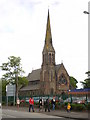

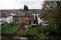
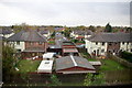
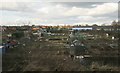
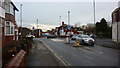
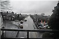
39 photos from this area
Area Information
Key information about the WA12 9JG including its size, population, and administrative classification.
- Area Type
- Postcode
- Area Size
- 4504 m²
- Population
- 1526
- Population Density
- 1461 people/km²
House Prices in WA12 9JG
14
Properties
£149,378
Average Sold Price
£31,151
Lowest Price
£223,000
Highest Price
Showing 14 properties
| Address | Type | Beds | Baths | Last Sale Price | Last Sale Date | |
|---|---|---|---|---|---|---|
| 22 Harrison Way, Newton Le Willows, St Helens, WA12 9JG | Semi-detached | 2 | 1 | £190,000 | Jun 2024 | |
| 46 Harrison Way, Newton Le Willows, St Helens, WA12 9JG | house | 3 | 1 | £220,000 | Feb 2023 | |
| 42 Harrison Way, Newton Le Willows, St Helens, WA12 9JG | house | - | - | £223,000 | Dec 2020 | |
| 34 Harrison Way, Newton Le Willows, St Helens, WA12 9JG | house | - | - | £175,000 | Nov 2020 | |
| 38 Harrison Way, Newton Le Willows, St Helens, WA12 9JG | Detached | 4 | 2 | £199,995 | May 2016 | |
| 24 Harrison Way, Newton Le Willows, St Helens, WA12 9JG | house | 3 | - | £174,000 | Feb 2016 | |
| 30 Harrison Way, Newton Le Willows, St Helens, WA12 9JG | Semi-detached | - | - | £180,000 | Oct 2015 | |
| 26 Harrison Way, Newton Le Willows, St Helens, WA12 9JG | Detached | - | - | £170,000 | Dec 2009 | |
| 36 Harrison Way, Newton Le Willows, St Helens, WA12 9JG | Detached | - | - | £174,500 | Nov 2006 | |
| 20 Harrison Way, Newton Le Willows, St Helens, WA12 9JG | Semi-detached | 2 | 1 | £87,500 | Feb 2004 |
Page 1 of 2
Energy Efficiency in WA12 9JG
Amenities
Schools
| Rank | School | Type | Entry gender | Ages |
|---|
Explore more schools in this area
Go to Schools tabDemographics
Household Size
One person
most common
Accommodation Type
Houses
most common
Tenure
76
majority
Ethnic Group
White
most common
Religion
N/A
most common
Household Composition
N/A
most common
Age
47
median
Adults (30-64 years)
most common
Household Deprivation
N/A
with no deprivation
NS-SEC
45
in Lower managerial occupations
Explore more demographic insights in this area
Go to Demographics tabPlanning
Planning Constraints
- Flood RiskPremium
- Ramsar Wetland SitesPremium
- Area of Outstanding Natural BeautyPremium
- Protected Nature ReservePremium
- Protected WoodlandPremium