Area Overview for WA12 0DL
Photos of WA12 0DL


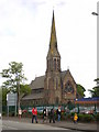

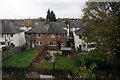
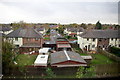
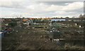
39 photos from this area
Area Information
Key information about the WA12 0DL including its size, population, and administrative classification.
- Area Type
- Postcode
- Area Size
- 659 m²
- Population
- 1682
- Population Density
- 503 people/km²
House Prices in WA12 0DL
35
Properties
£42,070
Average Sold Price
£15,500
Lowest Price
£82,500
Highest Price
Showing 35 properties
| Address | Type | Beds | Baths | Last Sale Price | Last Sale Date | |
|---|---|---|---|---|---|---|
| 27, Willow Court, The Parchments, Newton Le Willows, St Helens, WA12 0DL | Flat | - | - | £82,500 | Nov 2025 | |
| 34, Willow Court, The Parchments, Newton Le Willows, St Helens, WA12 0DL | Flat | - | - | £71,250 | May 2017 | |
| 25, Willow Court, The Parchments, Newton Le Willows, St Helens, WA12 0DL | Flat | - | - | £52,000 | Nov 2016 | |
| 28, Willow Court, The Parchments, Newton Le Willows, St Helens, WA12 0DL | Flat | - | - | £45,000 | Apr 2015 | |
| 31, Willow Court, The Parchments, Newton Le Willows, St Helens, WA12 0DL | Flat | - | - | £36,500 | Oct 2014 | |
| 30, Willow Court, The Parchments, Newton Le Willows, St Helens, WA12 0DL | Flat | - | - | £15,500 | Feb 2014 | |
| 32, Willow Court, The Parchments, Newton Le Willows, St Helens, WA12 0DL | Flat | - | - | £40,000 | Mar 2013 | |
| 24, Willow Court, The Parchments, Newton Le Willows, St Helens, WA12 0DL | Retirement | - | - | £25,000 | Sep 2012 | |
| 35, Willow Court, The Parchments, Newton Le Willows, St Helens, WA12 0DL | Flat | - | - | £23,000 | Oct 2011 | |
| 33, Willow Court, The Parchments, Newton Le Willows, St Helens, WA12 0DL | Flat | - | - | £29,950 | Aug 2004 |
Page 1 of 4
Energy Efficiency in WA12 0DL
Amenities
Schools
| Rank | School | Type | Entry gender | Ages |
|---|
Explore more schools in this area
Go to Schools tabDemographics
Household Size
Two person
most common
Accommodation Type
Houses
most common
Tenure
85
majority
Ethnic Group
White
most common
Religion
N/A
most common
Household Composition
N/A
most common
Age
47
median
Adults (30-64 years)
most common
Household Deprivation
N/A
with no deprivation
NS-SEC
47
in Lower managerial occupations
Explore more demographic insights in this area
Go to Demographics tabPlanning
Planning Constraints
- Flood RiskPremium
- Ramsar Wetland SitesPremium
- Area of Outstanding Natural BeautyPremium
- Protected Nature ReservePremium
- Protected WoodlandPremium