Area Overview for WA11 9BD
Photos of WA11 9BD
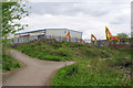
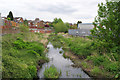
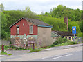
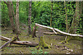
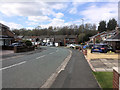
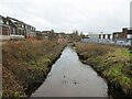
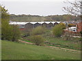
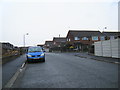
19 photos from this area
Area Information
Key information about the WA11 9BD including its size, population, and administrative classification.
- Area Type
- Postcode
- Area Size
- 2.5 hectares
- Population
- 1471
- Population Density
- 4840 people/km²
House Prices in WA11 9BD
56
Properties
£72,821
Average Sold Price
£30,000
Lowest Price
£110,000
Highest Price
Showing 56 properties
| Address | Type | Beds | Baths | Last Sale Price | Last Sale Date | |
|---|---|---|---|---|---|---|
| 73 Frodsham Drive, St Helens, WA11 9BD | Semi-detached | 2 | 1 | £105,530 | Dec 2022 | |
| 97 Frodsham Drive, St Helens, WA11 9BD | house | 2 | 1 | £102,000 | Nov 2022 | |
| 91 Frodsham Drive, St Helens, WA11 9BD | house | 3 | 1 | £110,000 | Jul 2022 | |
| 99 Frodsham Drive, St Helens, WA11 9BD | Terraced | 3 | 1 | £96,000 | Nov 2019 | |
| 41 Frodsham Drive, St Helens, WA11 9BD | Semi-detached | 3 | 1 | £65,000 | Nov 2018 | |
| 58 Frodsham Drive, St Helens, WA11 9BD | Terraced | 3 | 1 | £42,000 | Apr 2015 | |
| 62 Frodsham Drive, St Helens, WA11 9BD | house | 3 | 1 | £65,000 | Nov 2014 | |
| 77 Frodsham Drive, St Helens, WA11 9BD | Semi-detached | - | - | £58,500 | Jul 2014 | |
| 90 Frodsham Drive, St Helens, WA11 9BD | house | - | - | £58,500 | Mar 2011 | |
| 60 Frodsham Drive, St Helens, WA11 9BD | house | - | - | £68,500 | Oct 2006 |
Page 1 of 6
Energy Efficiency in WA11 9BD
Amenities
Schools
| Rank | School | Type | Entry gender | Ages |
|---|
Explore more schools in this area
Go to Schools tabDemographics
Household Size
Family (3-5 people)
most common
Accommodation Type
Houses
most common
Tenure
42
majority
Ethnic Group
White
most common
Religion
N/A
most common
Household Composition
N/A
most common
Age
47
median
Adults (30-64 years)
most common
Household Deprivation
N/A
with no deprivation
NS-SEC
16
in Lower managerial occupations
Explore more demographic insights in this area
Go to Demographics tabPlanning
Planning Constraints
- Flood RiskPremium
- Ramsar Wetland SitesPremium
- Area of Outstanding Natural BeautyPremium
- Protected Nature ReservePremium
- Protected WoodlandPremium