Area Overview for WA11 0LN
Photos of WA11 0LN
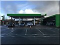
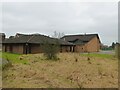
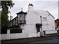
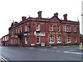

28 photos from this area
Area Information
Key information about the WA11 0LN including its size, population, and administrative classification.
- Area Type
- Postcode
- Area Size
- 3502 m²
- Population
- 1420
- Population Density
- 883 people/km²
House Prices in WA11 0LN
10
Properties
£84,730
Average Sold Price
£35,000
Lowest Price
£172,500
Highest Price
Showing 10 properties
| Address | Type | Beds | Baths | Last Sale Price | Last Sale Date | |
|---|---|---|---|---|---|---|
| 61 Kenyons Lane South, Haydock, St Helens, WA11 0LN | house | - | - | £80,000 | Jun 2022 | |
| 60 Kenyons Lane South, Haydock, St Helens, WA11 0LN | Detached | 3 | 2 | £172,500 | Jan 2021 | |
| 59 Kenyons Lane South, Haydock, St Helens, WA11 0LN | house | - | - | £61,150 | Aug 2020 | |
| 52 Kenyons Lane South, Haydock, St Helens, WA11 0LN | Semi-detached | - | - | £35,000 | Sep 2001 | |
| 63 Kenyons Lane South, Haydock, St Helens, WA11 0LN | Detached | - | - | £75,000 | Jun 1998 | |
| 55 Kenyons Lane South, Haydock, St Helens, WA11 0LN | Terraced | 2 | 1 | - | - | |
| 58 Kenyons Lane South, Haydock, St Helens, WA11 0LN | undefined | - | - | - | - | |
| 57 Kenyons Lane South, Haydock, St Helens, WA11 0LN | house | - | - | - | - | |
| 56-58 Kenyons Lane South, Haydock, St Helens, WA11 0LN | Terraced | - | - | - | - | |
| 54 Kenyons Lane South, Haydock, St Helens, WA11 0LN | Terraced | - | - | - | - |
Energy Efficiency in WA11 0LN
Amenities
Schools
| Rank | School | Type | Entry gender | Ages |
|---|
Explore more schools in this area
Go to Schools tabDemographics
Household Size
Two person
most common
Accommodation Type
Houses
most common
Tenure
76
majority
Ethnic Group
White
most common
Religion
N/A
most common
Household Composition
N/A
most common
Age
47
median
Adults (30-64 years)
most common
Household Deprivation
N/A
with no deprivation
NS-SEC
23
in Lower managerial occupations
Explore more demographic insights in this area
Go to Demographics tabPlanning
Planning Constraints
- Flood RiskPremium
- Ramsar Wetland SitesPremium
- Area of Outstanding Natural BeautyPremium
- Protected Nature ReservePremium
- Protected WoodlandPremium