Area Overview for WA11 0LD
Photos of WA11 0LD


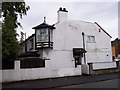
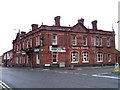
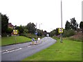
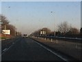

28 photos from this area
Area Information
Key information about the WA11 0LD including its size, population, and administrative classification.
- Area Type
- Postcode
- Area Size
- 5935 m²
- Population
- 1446
- Population Density
- 4526 people/km²
House Prices in WA11 0LD
24
Properties
£79,621
Average Sold Price
£12,000
Lowest Price
£160,000
Highest Price
Showing 24 properties
| Address | Type | Beds | Baths | Last Sale Price | Last Sale Date | |
|---|---|---|---|---|---|---|
| 186 Church Road, Haydock, St Helens, WA11 0LD | Semi-detached | 3 | 1 | £160,000 | Nov 2024 | |
| 174 Church Road, Haydock, St Helens, WA11 0LD | Terraced | 2 | 1 | £92,500 | Jul 2023 | |
| 172 Church Road, Haydock, St Helens, WA11 0LD | house | 2 | 1 | £85,000 | Apr 2023 | |
| 182 Church Road, Haydock, St Helens, WA11 0LD | Terraced | 2 | 1 | £105,000 | Mar 2023 | |
| 190 Church Road, Haydock, St Helens, WA11 0LD | Terraced | 2 | 2 | £106,000 | Jun 2021 | |
| 166 Church Road, Haydock, St Helens, WA11 0LD | Terraced | 3 | 1 | £85,000 | Jun 2018 | |
| 176 Church Road, Haydock, St Helens, WA11 0LD | Terraced | - | - | £88,000 | Jan 2007 | |
| 164 Church Road, Haydock, St Helens, WA11 0LD | Terraced | - | - | £87,000 | Dec 2006 | |
| 192 Church Road, Haydock, St Helens, WA11 0LD | Terraced | - | - | £74,000 | Apr 2004 | |
| 194 Church Road, Haydock, St Helens, WA11 0LD | Terraced | 2 | 1 | £25,000 | Mar 1999 |
Page 1 of 3
Energy Efficiency in WA11 0LD
Amenities
Schools
| Rank | School | Type | Entry gender | Ages |
|---|
Explore more schools in this area
Go to Schools tabDemographics
Household Size
One person
most common
Accommodation Type
Houses
most common
Tenure
56
majority
Ethnic Group
White
most common
Religion
N/A
most common
Household Composition
N/A
most common
Age
47
median
Adults (30-64 years)
most common
Household Deprivation
N/A
with no deprivation
NS-SEC
24
in Lower managerial occupations
Explore more demographic insights in this area
Go to Demographics tabPlanning
Planning Constraints
- Flood RiskPremium
- Ramsar Wetland SitesPremium
- Area of Outstanding Natural BeautyPremium
- Protected Nature ReservePremium
- Protected WoodlandPremium