Area Overview for WA11 0GA
Photos of WA11 0GA


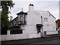
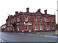
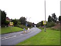


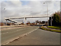
28 photos from this area
Area Information
Key information about the WA11 0GA including its size, population, and administrative classification.
- Area Type
- Postcode
- Area Size
- 7142 m²
- Population
- 1420
- Population Density
- 883 people/km²
House Prices in WA11 0GA
23
Properties
£138,471
Average Sold Price
£52,000
Lowest Price
£205,000
Highest Price
Showing 23 properties
| Address | Type | Beds | Baths | Last Sale Price | Last Sale Date | |
|---|---|---|---|---|---|---|
| 22 Bluebell Avenue, Haydock, St Helens, WA11 0GA | Semi-detached | 3 | 1 | £195,000 | Jun 2025 | |
| 2 Bluebell Avenue, Haydock, St Helens, WA11 0GA | Semi-detached | 3 | 1 | £195,000 | Jun 2025 | |
| 3 Bluebell Avenue, Haydock, St Helens, WA11 0GA | Semi-detached | 3 | 1 | £193,000 | May 2025 | |
| 26 Bluebell Avenue, Haydock, St Helens, WA11 0GA | Semi-detached | 3 | 1 | £185,000 | Mar 2025 | |
| 7 Bluebell Avenue, Haydock, St Helens, WA11 0GA | Semi-detached | 3 | 1 | £200,000 | Sep 2024 | |
| 28 Bluebell Avenue, Haydock, St Helens, WA11 0GA | Semi-detached | 3 | 1 | £178,000 | May 2024 | |
| 15 Bluebell Avenue, Haydock, St Helens, WA11 0GA | Detached | - | - | £205,000 | Oct 2023 | |
| 18 Bluebell Avenue, Haydock, St Helens, WA11 0GA | house | - | - | £166,000 | Dec 2021 | |
| 30 Bluebell Avenue, Haydock, St Helens, WA11 0GA | house | - | - | £154,000 | Jul 2021 | |
| 13 Bluebell Avenue, Haydock, St Helens, WA11 0GA | Semi-detached | 3 | 1 | £147,000 | May 2021 |
Page 1 of 3
Energy Efficiency in WA11 0GA
Amenities
Schools
| Rank | School | Type | Entry gender | Ages |
|---|
Explore more schools in this area
Go to Schools tabDemographics
Household Size
Two person
most common
Accommodation Type
Houses
most common
Tenure
76
majority
Ethnic Group
White
most common
Religion
N/A
most common
Household Composition
N/A
most common
Age
47
median
Adults (30-64 years)
most common
Household Deprivation
N/A
with no deprivation
NS-SEC
23
in Lower managerial occupations
Explore more demographic insights in this area
Go to Demographics tabPlanning
Planning Constraints
- Flood RiskPremium
- Ramsar Wetland SitesPremium
- Area of Outstanding Natural BeautyPremium
- Protected Nature ReservePremium
- Protected WoodlandPremium