Area Overview for WA11 0FA
Photos of WA11 0FA
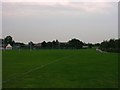
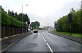
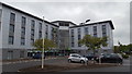

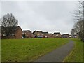


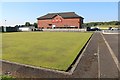
19 photos from this area
Area Information
Key information about the WA11 0FA including its size, population, and administrative classification.
- Area Type
- Postcode
- Area Size
- 2.8 hectares
- Population
- 1567
- Population Density
- 3929 people/km²
House Prices in WA11 0FA
74
Properties
£126,820
Average Sold Price
£1,125
Lowest Price
£310,000
Highest Price
Showing 74 properties
| Address | Type | Beds | Baths | Last Sale Price | Last Sale Date | |
|---|---|---|---|---|---|---|
| 28 Ashbury Drive, Haydock, St Helens, WA11 0FA | Detached | 3 | 2 | £310,000 | Mar 2025 | |
| 26 Ashbury Drive, Haydock, St Helens, WA11 0FA | Detached | 3 | 3 | £265,000 | Nov 2024 | |
| 6 Ashbury Drive, Haydock, St Helens, WA11 0FA | Semi-detached | 3 | 1 | £225,000 | Nov 2024 | |
| 49 Ashbury Drive, Haydock, St Helens, WA11 0FA | Semi-detached | 2 | 1 | £180,000 | Jun 2024 | |
| 57 Ashbury Drive, Haydock, St Helens, WA11 0FA | Detached | 4 | 3 | £270,000 | Nov 2023 | |
| 44 Ashbury Drive, Haydock, St Helens, WA11 0FA | Semi-detached | 4 | 1 | £205,000 | May 2023 | |
| 24 Ashbury Drive, Haydock, St Helens, WA11 0FA | Semi-detached | 3 | 1 | £210,000 | Dec 2022 | |
| 56 Ashbury Drive, Haydock, St Helens, WA11 0FA | Retail | 3 | 1 | £231,000 | Mar 2022 | |
| 35 Ashbury Drive, Haydock, St Helens, WA11 0FA | house | - | - | £275,000 | Jun 2021 | |
| 58 Ashbury Drive, Haydock, St Helens, WA11 0FA | house | - | - | £277,500 | Jun 2021 |
Page 1 of 8
Energy Efficiency in WA11 0FA
Amenities
Schools
| Rank | School | Type | Entry gender | Ages |
|---|
Explore more schools in this area
Go to Schools tabDemographics
Household Size
Two person
most common
Accommodation Type
Houses
most common
Tenure
87
majority
Ethnic Group
White
most common
Religion
N/A
most common
Household Composition
N/A
most common
Age
47
median
Adults (30-64 years)
most common
Household Deprivation
N/A
with no deprivation
NS-SEC
33
in Lower managerial occupations
Explore more demographic insights in this area
Go to Demographics tabPlanning
Planning Constraints
- Flood RiskPremium
- Ramsar Wetland SitesPremium
- Area of Outstanding Natural BeautyPremium
- Protected Nature ReservePremium
- Protected WoodlandPremium