Area Overview for WA1 3LD
Photos of WA1 3LD
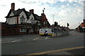
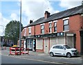
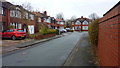
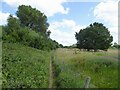
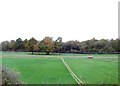
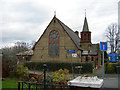
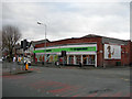
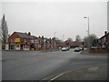
18 photos from this area
Area Information
Key information about the WA1 3LD including its size, population, and administrative classification.
- Area Type
- Postcode
- Area Size
- 8549 m²
- Population
- 1638
- Population Density
- 2913 people/km²
House Prices in WA1 3LD
30
Properties
£98,517
Average Sold Price
£38,000
Lowest Price
£180,000
Highest Price
Showing 30 properties
| Address | Type | Beds | Baths | Last Sale Price | Last Sale Date | |
|---|---|---|---|---|---|---|
| 227 Padgate Lane, Warrington, WA1 3LD | Retail | 3 | 1 | £171,000 | Feb 2023 | |
| 231 Padgate Lane, Warrington, WA1 3LD | Semi-detached | 3 | 1 | £180,000 | Feb 2019 | |
| 233 Padgate Lane, Warrington, WA1 3LD | house | - | - | £135,000 | Aug 2015 | |
| 221 Padgate Lane, Warrington, WA1 3LD | Semi-detached | 3 | - | £143,000 | Jul 2015 | |
| 199 Padgate Lane, Warrington, WA1 3LD | Terraced | 3 | 1 | £94,000 | Apr 2014 | |
| 205 Padgate Lane, Warrington, WA1 3LD | Terraced | 3 | - | £123,000 | Oct 2008 | |
| 219 Padgate Lane, Warrington, WA1 3LD | house | - | - | £92,950 | Apr 2003 | |
| 209 Padgate Lane, Warrington, WA1 3LD | Semi-detached | - | - | £71,800 | Aug 2001 | |
| 225 Padgate Lane, Warrington, WA1 3LD | house | - | - | £46,000 | Feb 2000 | |
| 211 Padgate Lane, Warrington, WA1 3LD | Semi-detached | - | - | £48,950 | Aug 1997 |
Page 1 of 3
Energy Efficiency in WA1 3LD
Amenities
Schools
| Rank | School | Type | Entry gender | Ages |
|---|
Explore more schools in this area
Go to Schools tabDemographics
Household Size
Family (3-5 people)
most common
Accommodation Type
Houses
most common
Tenure
85
majority
Ethnic Group
White
most common
Religion
N/A
most common
Household Composition
N/A
most common
Age
47
median
Adults (30-64 years)
most common
Household Deprivation
N/A
with no deprivation
NS-SEC
33
in Lower managerial occupations
Explore more demographic insights in this area
Go to Demographics tabPlanning
Planning Constraints
- Flood RiskPremium
- Ramsar Wetland SitesPremium
- Area of Outstanding Natural BeautyPremium
- Protected Nature ReservePremium
- Protected WoodlandPremium