Area Overview for WA1 2JW
Photos of WA1 2JW
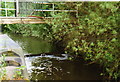
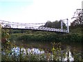
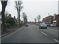
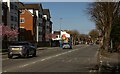
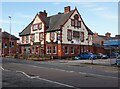
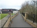
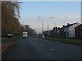


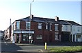
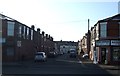
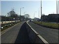
25 photos from this area
Area Information
Key information about the WA1 2JW including its size, population, and administrative classification.
- Area Type
- Postcode
- Area Size
- 8146 m²
- Population
- 2270
- Population Density
- 3971 people/km²
House Prices in WA1 2JW
32
Properties
£79,200
Average Sold Price
£68,000
Lowest Price
£95,000
Highest Price
Showing 32 properties
| Address | Type | Beds | Baths | Last Sale Price | Last Sale Date | |
|---|---|---|---|---|---|---|
| 8 Harbord Street, Fairfield And Howley, Warrington, WA1 2JW | Flat | 1 | 1 | £95,000 | Apr 2025 | |
| 23 Harbord Street, Fairfield And Howley, Warrington, WA1 2JW | Flat | 1 | 1 | £90,000 | Sep 2024 | |
| 29 Harbord Street, Fairfield And Howley, Warrington, WA1 2JW | Flat | 1 | 1 | £73,000 | Feb 2022 | |
| 7 Harbord Street, Fairfield And Howley, Warrington, WA1 2JW | Flat | - | - | £68,000 | Aug 2018 | |
| 20 Harbord Street, Fairfield And Howley, Warrington, WA1 2JW | Flat | - | - | £70,000 | Jul 2007 | |
| Tyres R Us, Harbord Street, Fairfield And Howley, Warrington, WA1 2JW | Industrial | - | - | - | - | |
| 4 Harbord Street, Fairfield And Howley, Warrington, WA1 2JW | Flat | - | - | - | - | |
| 3 Harbord Street, Fairfield And Howley, Warrington, WA1 2JW | Flat | - | - | - | - | |
| 14 Harbord Street, Fairfield And Howley, Warrington, WA1 2JW | Flat | - | - | - | - | |
| 10 Harbord Street, Fairfield And Howley, Warrington, WA1 2JW | Flat | - | - | - | - |
Page 1 of 4
Energy Efficiency in WA1 2JW
Amenities
Schools
| Rank | School | Type | Entry gender | Ages |
|---|
Explore more schools in this area
Go to Schools tabDemographics
Household Size
One person
most common
Accommodation Type
Houses
most common
Tenure
34
majority
Ethnic Group
White
most common
Religion
N/A
most common
Household Composition
N/A
most common
Age
47
median
Adults (30-64 years)
most common
Household Deprivation
N/A
with no deprivation
NS-SEC
26
in Lower managerial occupations
Explore more demographic insights in this area
Go to Demographics tabPlanning
Planning Constraints
- Flood RiskPremium
- Ramsar Wetland SitesPremium
- Area of Outstanding Natural BeautyPremium
- Protected Nature ReservePremium
- Protected WoodlandPremium