Area Overview for Twemlow
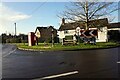
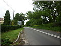
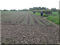
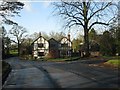
Photos of Twemlow


Area Information
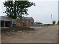
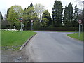
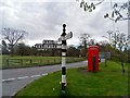
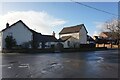
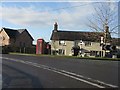
Living in Twemlow offers a distinct character within Cheshire East, defined by its compact size and historic roots. This civil parish covers just 3.9 km², containing the village of Twemlow Green. You are positioned on the A535 road, with boundaries touching Goostrey to the north and Cranage to the west. The landscape is shaped by the River Dane to the south, which separates you from Holmes Chapel and Brereton. Historically significant, Twemlow was a township in ancient Cheshire that became a civil parish in 1866. You walk past heritage assets like the Grade-II-listed Twemlow Viaduct, a brick structure built in 1841 for the Manchester and Birmingham Railway. This route now forms part of the West Coast Main Line. The Dane Valley Way long-distance footpath passes through the area, connecting walkers across the parish. Twemlow Hall, originally a timber-framed Tudor building constructed for the Booth family in the 16th century, stands as a testament to the local history. The area lies within Church Hulme sub-district and was formed partly through a boundary change in 1889 that incorporated land from Rudheath. Your daily life here is grounded in these physical and historical markers rather than urban sprawl. The location provides a quiet setting where the past remains visible alongside modern transport links.
- Area Type
- Parish
- Area Size
- 3.9 km²
- Population
- Not available
- Population Density
- Not available
Demographics
The community profile in Twemlow reflects a settled population with specific demographic markers. The median age across the parish stands at 70, indicating a predominantly older resident base. You will find that age is the primary demographic descriptor currently available for this locality. Home ownership is the dominant tenure model inTwemlow, with 79% of households owning their property outright or with a mortgage. This high ownership rate suggests a stable community with long-term residents rather than a transient rental market. The data does not specify the breakdown of household composition or the proportion of shared versus single-family homes. Ethnic diversity and religious affiliation statistics are not detailed in the current records for the parish. Deprivation metrics are also absent from the available information you can review. While the high home ownership percentage of 79% implies financial stability, you must note the lack of granular data on income levels or social mobility. The absence of specific figures on household types means you cannot determine the balance of families, singles, or multi-generational households. These missing details prevent a full picture of daily social interactions within Twemlow. However, the overwhelming majority of ownership at 79% points to an area where residents have strong ties to their homes.
Household Size
Accommodation Type
Tenure
Ethnic Group
Religion
Household Composition
Age
Household Deprivation
NS-SEC
Explore more demographic insights in this area
Go to Demographics tabPlanning
Planning Constraints
- Flood RiskPremium
- Ramsar Wetland SitesPremium
- Area of Outstanding Natural BeautyPremium
- Protected Nature ReservePremium
- Protected WoodlandPremium
- Crime RiskPremium