Area Overview for Tuebrook Larkhill Ward
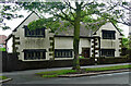
Photos of Tuebrook Larkhill Ward

Area Information
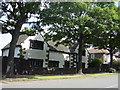
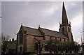
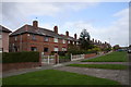
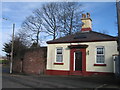
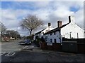
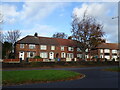
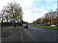
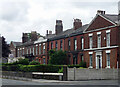
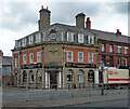
Tuebrook Larkhill Ward is an electoral ward located in north Liverpool, England, serving as a distinct district within the city borough. The area spans a compact footprint of just 1.1 km², yet it accommodates a population of 2,957 residents. This density creates a neighbourhood where daily life moves with a sense of immediacy, shaped by specific local boundaries that follow Townsend Lane, Queens Drive, West Derby Road, and the Canada Dock Branch line. The ward occupies parliamentary constituencies of Liverpool West Derby and Liverpool Walton, positioning it within a well-defined administrative landscape. Its modern history includes a boundary review by the Local Government Boundary Commission for England in 2023, which formed the new entity from parts of the former Tuebrook and Stoneycroft ward alongside a small section of Clubmoor. The name itself carries historical weight, referencing an 18th-century estate known as Lark Hill, which Richard Heywood purchased in 1776 from Jonathan Blundell. For anyone considering living in Tuebrook Larkhill Ward, the area offers a specific context of recent local government history blended with older geographical roots. The ward provides a clearly defined space for those seeking a home in north Liverpool.
- Area Type
- District Borough Unitary Ward
- Area Size
- 1.1 km²
- Population
- 2957
- Population Density
- 2751 people/km²
Demographics
The community within Tuebrook Larkhill Ward is defined largely by its age profile, with a median age of seventy years. This figure indicates a population heavily weighted towards older residents, suggesting a neighbourhood where retirement living and established families may be prominent. Within this context, the household composition reflects the maturity of the area, contrasting sharply with younger, transient districts. Home ownership stands at forty-nine percent, meaning that nearly half of all households own their properties outright or with a mortgage. This ownership level suggests a stable community where many residents have long-term ties to the ward. The remaining households reside in other forms of accommodation, though the specific breakdown of rental types is not detailed in the available records. Ethnicity and religious data are listed as total figures without further breakdown, indicating that the area likely contains a mix of backgrounds that does not skew heavily towards a single demographic. For those looking at schools near Tuebrook Larkhill Ward, the area's older demographic suggests a demand for education that caters to younger generations joining this established population. The social fabric here is rooted in stability, characterised by a high proportion of long-term residents who own their homes.
Household Size
Accommodation Type
Tenure
Ethnic Group
Religion
Household Composition
Age
Household Deprivation
NS-SEC
Explore more demographic insights in this area
Go to Demographics tabPlanning
Planning Constraints
- Flood RiskPremium
- Ramsar Wetland SitesPremium
- Area of Outstanding Natural BeautyPremium
- Protected Nature ReservePremium
- Protected WoodlandPremium
- Crime RiskPremium