Area Overview for Tonge with the Haulgh Ward
Photos of Tonge with the Haulgh Ward


Area Information
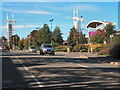
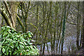
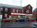
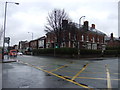
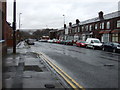
Tonge with the Haulgh Ward occupies a distinctive geographical position as an electoral ward within the unitary authority of Bolton. This district encompasses the former townships of Tonge and Haulgh, situated on a narrow tongue of land between the River Tonge and Bradshaw Brook near their confluence. The ward covers an area of 4.1 square kilometres and is home to a population of 2,810 residents. You will find central coordinates at 53.585767 and a primary postcode of BL1 2TU, indicating its integration into the broader urban fabric of Bolton. History defines the location, with the name Tonge deriving from Old English for a fork in a river. The landscape includes Tonge Moor, historically rural with weaving folds like Tonge Fold and Tomlin Fold, where the Starkie and Norris families once resided near Hall i' th' Wood. Cotton manufacture was established by 1845 when the chapelry was constituted. Today, the Medieval hall and nearby Starkie Arms serve as reminders of the area's deep industrial and agricultural past. Living in Tonge with the Haulgh Ward means accessing a site rich in Bronze Age archaeology alongside its modern utility. The ward represents a compact, historically significant pocket of Greater Manchester where the past remains visibly connected to the present.
- Area Type
- District Borough Unitary Ward
- Area Size
- 4.1 km²
- Population
- 2810
- Population Density
- 691 people/km²
Demographics
The community profile of Tonge with the Haulgh Ward reveals a significantly older demographic compared to the national average. The median age stands at 70 years, indicating a population dominated by older adults. Historical data categorises the most common age range simply as Total, reflecting a broad spread likely skewed towards retirement ages. Home ownership represents a significant holding ground for residents, with 50% of the population owning their property outright or with a mortgage. This figure suggests a stable tenure base typical of historic estates rather than modern social housing developments. You will encounter a mixture of accommodation types, though specific breakdowns between flats and houses are not detailed in current records. The household composition and predominant ethnic groups are recorded only as total figures, lacking granular splits. Religion data similarly aggregates rather than differentiating specific denominations. This demographic structure implies a quieter, perhaps more sedate lifestyle where many residents enjoy the later stages of life. The high home ownership rate often correlates with established communities that have remained in place over successive generations. When considering homes in Tonge with the Haulgh Ward, understanding this age profile is essential for matching with your specific needs.
Household Size
Accommodation Type
Tenure
Ethnic Group
Religion
Household Composition
Age
Household Deprivation
NS-SEC
Explore more demographic insights in this area
Go to Demographics tabPlanning
Planning Constraints
- Flood RiskPremium
- Ramsar Wetland SitesPremium
- Area of Outstanding Natural BeautyPremium
- Protected Nature ReservePremium
- Protected WoodlandPremium
- Crime RiskPremium