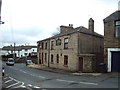
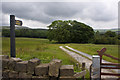
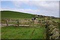
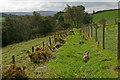
Area Overview for Tockholes
Photos of Tockholes


Area Information
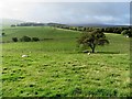
Living in Tockholes means settling into a small civil parish with a distinct character defined by its rural setting and established community. This area covers 9.2 km², offering a compact space where residents enjoy a quiet atmosphere away from the pace of larger towns. You will find a locality that prioritises a slower lifestyle, where daily life revolves around local familiarity and a strong sense of neighbourhood. The parish identity provides a clear boundary for those seeking a specific type of rural experience within England. Prospective buyers should appreciate that this is a defined residential zone rather than a suburb of a bigger city. Your days here will likely involve walking the boundaries of this specific land area or engaging with neighbours who have known each other for generations. The scale of the parish ensures that it remains manageable, preventing the sprawl often associated with expanding urban areas. Instead, you get a focused environment where the community centre, local lanes, and surrounding green spaces form the core of everyday life. When you consider homes in Tockholes, you are choosing a location with a fixed footprint and a history of local governance that dates back decades.
- Area Type
- Parish
- Area Size
- 9.2 km²
- Population
- Not available
- Population Density
- Not available
Demographics
The community profile in Tockholes reflects an established and settled population. You will find that the median age within the parish is 70, indicating that this is predominantly a retirement or mature location rather than a family hub. Most common age data confirms a demographic skew toward older residents, meaning the streets are populated by those seeking a quieter phase of life. Home ownership stands at an impressive 89%, demonstrating that the vast majority of households have purchased their properties outright or own with a mortgage. This high rate of ownership suggests financial stability within the community and a long-term commitment to the area. Household composition and accommodation type data further support the idea of stability, as residents tend to stay put and maintain their homes for extended periods. The predominant ethnic group and religious statistics point to a homogenous community, though specific breakdown percentages are not listed in the available records. For you, this translates into a neighbourly environment where long-standing residents know each other well. A buy-to-let market is minimal because fewer than 10% of homes are owned by landlords. You are looking at an area where people buy to live, not to rent out.
Household Size
Accommodation Type
Tenure
Ethnic Group
Religion
Household Composition
Age
Household Deprivation
NS-SEC
Explore more demographic insights in this area
Go to Demographics tabPlanning
Planning Constraints
- Flood RiskPremium
- Ramsar Wetland SitesPremium
- Area of Outstanding Natural BeautyPremium
- Protected Nature ReservePremium
- Protected WoodlandPremium
- Crime RiskPremium