Area Overview for Stretford
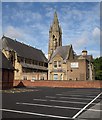
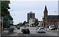
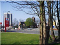
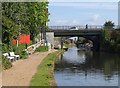
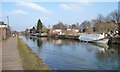
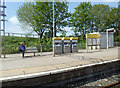
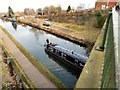
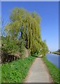
Photos of Stretford


Area Information
Stretford is a compact built-up area in England, spanning 4.4 km² and home to 5,310 residents. Its population density of 1,199 people per square kilometre reflects a tightly knit community, though the median age of 70 suggests a predominantly older demographic. Living in Stretford offers proximity to a range of amenities, from retail hubs like Heron Stretford and Asda Sevenways to transport links such as Trafford Park Railway Station and Manchester United FC Railway Station. The area’s strategic location near Old Trafford and City Airport Manchester enhances its appeal for commuters and frequent travellers. Daily life here is shaped by its mature population, with a focus on accessibility to local services and public transport. While the high population density may influence the pace of life, the presence of five primary schools, including Moss Park Primary School with an outstanding Ofsted rating, ensures families have educational options. Stretford’s blend of practicality and connectivity makes it a viable choice for those prioritising convenience over sprawling urban spaces.
- Area Type
- Built Up Area 250
- Area Size
- 4.4 km²
- Population
- 5310
- Population Density
- 1199 people/km²
Stretford’s lifestyle is defined by its accessibility to retail, leisure, and transport. Local shops such as Heron Stretford, Asda Sevenways, and Aldi Stretford provide everyday essentials, while nearby rail and metro stations facilitate quick access to Manchester’s cultural and commercial centres. The area’s proximity to Old Trafford and City Airport Manchester adds convenience for sports enthusiasts and travellers. Parks and green spaces are not explicitly named, but the presence of schools like Moss Park Primary School suggests nearby recreational areas. The mix of retail, transport, and proximity to major landmarks ensures a practical daily life, though the data does not detail specific leisure facilities. For residents valuing convenience over sprawling amenities, Stretford’s compact layout offers a balance of accessibility and community-focused living.
Amenities
Schools
Stretford’s proximity to five primary schools offers families a range of educational options. Barton Clough Primary School and Moss Park Infant School serve younger children, while Gorse Hill Primary School and Victoria Park Junior School hold Ofsted ratings of ‘good’. Moss Park Primary School stands out with an ‘outstanding’ rating, reflecting high standards in teaching and facilities. The mix of schools ensures that parents can choose between established institutions with strong reputations and newer ones with emerging programmes. For families prioritising academic excellence, Moss Park’s rating is a clear advantage. The concentration of primary schools within practical reach of residents underscores Stretford’s suitability for households with children. However, the data does not include secondary schools, so prospective buyers should investigate further for comprehensive education planning.
| Rank | School | Type | Entry gender | Ages |
|---|
Explore more schools in this area
Go to Schools tabDemographics
Stretford’s demographic profile is defined by a median age of 70, indicating a community skewed towards older adults. This age group dominates the population, with no specific data on younger residents. Home ownership stands at 64%, suggesting a mix of long-term residents and property investors. The accommodation types are not detailed, but the overall household composition is described as ‘total’, offering no breakdown of family structures or single-person households. The area’s diversity is not quantified in the data, but the absence of specific ethnic or religious statistics means its cultural makeup remains unexplored here. The high median age may influence local services, with healthcare and leisure facilities likely tailored to older demographics. For prospective buyers, this profile implies a mature, stable community, though it also raises questions about the presence of younger families or professionals seeking dynamic environments.