Area Overview for Strawberry Ward
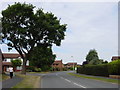
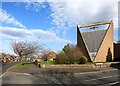
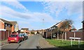
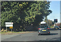
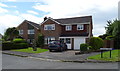
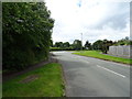
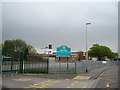
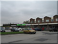
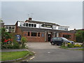
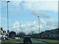
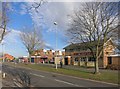
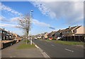
Photos of Strawberry Ward
Area Information
Living in Strawberry Ward offers a quiet residential experience focused on the suburbs of Strawberry Park and Strawberry Fields within Ellesmere Port. This district borough unitary ward sits in the North West region, covering a compact area of 1 kilometre squared. You will find the location positioned south of Hope Farm and west of Backford Cross at specific coordinates of approximately 53.264125, -2.923091. The area functions as a distinct neighbourhood within Cheshire West and Chester Council, providing a settled environment for families and individuals. Prospective homebuyers looking at homes in Strawberry Ward are entering a defined community that lacks the complexity of larger urban councils. The ward represents a straightforward postcode zone where daily life revolves around local proximity. Your daily routine involves navigating a small geographical footprint where distance to major landmarks is minimal. This specificity makes Strawberry Ward easy to visit and explore. You do not need to travel far to reach specific points of interest within the local boundary. The compact nature of the land ensures that everything is relatively close to your door.
- Area Type
- District Borough Unitary Ward
- Area Size
- 1.0 km²
- Population
- Not available
- Population Density
- Not available
Demographics
The community in Strawberry Ward is defined by a mature population profile. The median age for residents is exactly 70 years, indicating a predominantly older demographic living in the area. When analysing household composition and accommodation types, a distinct pattern emerges regarding tenure. Home preservation is the norm, with 91 per cent of residents owning their properties outright or via mortgage. This figure leaves only a small minority who rent. The age data suggests a retirement community or a location where people stay as they grow older. You are unlikely to find a high turnover of young renters or transient workers here. The population structure points towards stability over change. Those considering schools near Strawberry Ward should note that the area caters primarily to seniors and established families rather than young children. The demographic safety score of 85 reflects a low crime risk environment where the elderly can feel secure. This strong sense of security aligns with the high rate of property ownership. Nearly every household in Strawberry Ward belongs to the total list of residents who claim ownership. This concentration of owners creates a neighbourhood where neighbours know one another well over long periods.
Household Size
Accommodation Type
Tenure
Ethnic Group
Religion
Household Composition
Age
Household Deprivation
NS-SEC
Explore more demographic insights in this area
Go to Demographics tabPlanning
Planning Constraints
- Flood RiskPremium
- Ramsar Wetland SitesPremium
- Area of Outstanding Natural BeautyPremium
- Protected Nature ReservePremium
- Protected WoodlandPremium
- Crime RiskPremium