Area Overview for Stoke and Hurleston
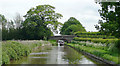
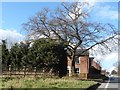
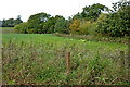
Photos of Stoke and Hurleston


Area Information
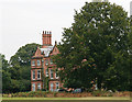
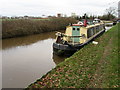
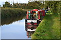
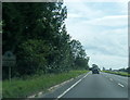
Stoke and Hurleston is a small civil parish covering an area of 8.2 km². You will find this community situated in a relatively compact footprint, which often means distances to local amenities are short. Daily life here feels distinct from larger towns due to this limited scale. The area functions as a close-knit parish where residents know their neighbours. This setting creates a quiet environment suitable for those seeking a slower pace. You do not experience the congestion found in urban centres when moving around this parish. The boundaries are clearly defined and the character is that of a traditional English settlement. Life revolves around local needs and immediate surroundings. You can walk to most necessities within the parish limits. This compactness offers convenience for children or retirees who require frequent stops throughout the day. The physical size of 8.2 km² ensures that you are never too far from your home. Streets are familiar and the layout is straightforward to navigate. This small parish provides a contained community feel that larger areas simply cannot replicate.
- Area Type
- Parish
- Area Size
- 8.2 km²
- Population
- Not available
- Population Density
- Not available
Demographics
The community in Stoke and Hurleston reflects an older population profile. The median age across the parish stands at 70 years. This statistic indicates that you are buying into an area dominated by retirees and former residents. Most people living here fall into the older age demographics. Home ownership is the standard arrangement for households in Stoke and Hurleston. Three quarters of residents, representing 74% of the population, own their homes outright or have a mortgage. Rental properties are very rare within this specific boundary. The high ownership rate suggests long-term stability within the local community. Household composition data indicates a diverse range of living arrangements typical for an area with this age profile. You will likely encounter single occupants or couples living together in many streets. Accommodation types mirror the settled nature of the parish, offering a stable environment rather than transient housing. The demographic data paints a clear picture of a quiet, settled community where neighbours often know each other well after decades of residency. This density of older owners creates a specific social atmosphere unique to Stoke and Hurleston.
Household Size
Accommodation Type
Tenure
Ethnic Group
Religion
Household Composition
Age
Household Deprivation
NS-SEC
Explore more demographic insights in this area
Go to Demographics tabPlanning
Planning Constraints
- Flood RiskPremium
- Ramsar Wetland SitesPremium
- Area of Outstanding Natural BeautyPremium
- Protected Nature ReservePremium
- Protected WoodlandPremium
- Crime RiskPremium