Area Overview for Stanwix Rural
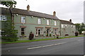
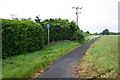
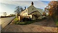
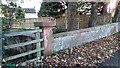
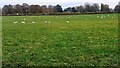
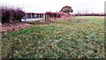
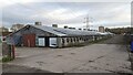
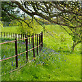
Photos of Stanwix Rural
Area Information
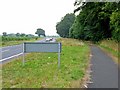
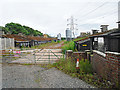
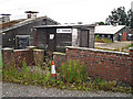
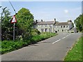
Living in Stanwix Rural means residing within a civil parish in Cumbria, England, that spans 25.4 km² of distinct rural landscape. This community represents the northern sections of the historic parish of Stanwix, separated from the urban village of the same name when the original parish divided in 1966. The area supports a population of approximately 1,497 people across several small settlements, hamlets, and villages. You will find yourself on ground with deep historical significance, standing on the site of the ancient Roman fort Uxelodunum and the Vallum of Hadrian's Wall. The ancient name derives from stone-built houses that predated Roman settlement, contrasting with the more common wattle-and-daub structures of the era. The parish tells a story of Anglo-Saxon and Norse heritage, reflected in local place names ending in -ton and -by. King Edward I passed through the area multiple times during the 13th century, staying at Linstock Castle while Parliaments were held in Carlisle. Bonnie Prince Charlie also stopped here during his 1745 attempt to regain the British throne. Daily life in the parish is grounded in this rich history, surrounded by Red sandstone and red brick buildings typical of North Cumbrian vernacular design. St Michael's Church stands prominently at the top of a steep bank rising from the River Eden. For anyone looking at Stanwix Rural, the setting offers a tangible connection to centuries of English history in the North West region.
- Area Type
- Parish
- Area Size
- 25.4 km²
- Population
- Not available
- Population Density
- Not available
Demographics
The community in Stanwix Rural is defined by an established population with a median age of 70. This figure indicates a predominantly older demographic, where the most common age range extends beyond the working years. You will find that 85 per cent of households own their homes, creating a neighbourhood where stability and long-term residence are the norm. The low rental market presence suggests that residents are less likely to move frequently or chase short-term opportunities. Household composition data covering the total population shows a community that has matured over time. The area contains distinct communities that have likely developed a tightly knit social structure reflecting its age profile. While the parish includes several distinct communities, hamlets, and small settlements, the overall character remains consistent with other areas where home ownership dominates. The demographic profile points to residents who have put down roots for decades or generations. This concentration of elderly residents often aligns with specific housing needs and lifestyle choices that differ from younger urban centres. Anyone considering homes in Stanwix Rural should be aware that the social dynamics will centre on an older population base. The area does not show significant diversification in household types, reinforcing the pattern of traditional family structures or single-occupation retired households.
Household Size
Accommodation Type
Tenure
Ethnic Group
Religion
Household Composition
Age
Household Deprivation
NS-SEC
Explore more demographic insights in this area
Go to Demographics tabPlanning
Planning Constraints
- Flood RiskPremium
- Ramsar Wetland SitesPremium
- Area of Outstanding Natural BeautyPremium
- Protected Nature ReservePremium
- Crime RiskPremium