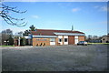
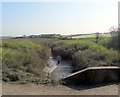
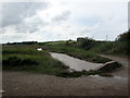
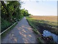
Area Overview for Stanah Ward
Photos of Stanah Ward

Area Information
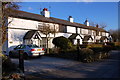
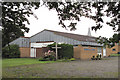
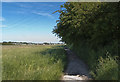
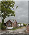
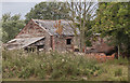
Living in Stanah Ward means settling into a compact district borough unitary ward that covers just 4.0 square kilometres. This small size dictates the pace of daily life, as distances between local amenities and homes are inherently short. The area stands apart from many other parts of England due to its predominantly older demographic and extremely high levels of property ownership. You will find a community where stability is the norm, shaped by a history of long-term residency rather than transient living patterns. The median age of 70 characterizes the population, suggesting a neighbourhood where retired couples and established families form the core of the social fabric. When you walk the streets of Stanah Ward, you are likely to encounter residents who have called this specific four-square-kilometre location their home for decades. The lack of major planning constraints regarding protected natural reserves or woodlands indicates a managed landscape rather than a heavily restricted one. This clear administrative definition of the ward allows for straightforward understanding of local boundaries for any prospective buyer. The environment is defined by its extreme age profile and the rarity of a neighbourhood where 86 per cent of residents own their property outright. This unique statistical profile sets Stanah Ward apart as a place of deep-rooted community ties and significant asset retention.
- Area Type
- District Borough Unitary Ward
- Area Size
- 4.0 km²
- Population
- Not available
- Population Density
- Not available
Demographics
The community within Stanah Ward is defined by an exceptionally mature population. With a median age of 70, this area contrasts sharply with national averages for working-age families or young professionals seeking to settle down. The most common age range is listed as 'Total', reflecting the broad demographic skew entirely toward the older population bracket. This age profile influences local services and social activities, prioritising needs specific to later life. Home ownership in Stanah Ward reaches 86 per cent, which is a remarkable figure that underscores the stability of the local households. This high rate of ownership means that the vast majority of residents live in properties they own outright or have substantial equity, rather than renting each month. The household composition and accommodation type data confirm a settled living environment where long-term tenures are the standard. There is minimal pressure from mobile worker families or students, creating a quiet residential atmosphere. While specific data on predominant ethnic groups and religious affiliation is not detailed in the current figures, the high ownership percentage suggests established families who have built their lives in the ward. For anyone considering living in Stanah Ward, the demographic reality is clear; you are entering a mature community where the primary focus is on stability and the quality of life for older adults.
Household Size
Accommodation Type
Tenure
Ethnic Group
Religion
Household Composition
Age
Household Deprivation
NS-SEC
Explore more demographic insights in this area
Go to Demographics tabPlanning
Planning Constraints
- Flood RiskPremium
- Ramsar Wetland SitesPremium
- Area of Outstanding Natural BeautyPremium
- Protected Nature ReservePremium
- Protected WoodlandPremium
- Crime RiskPremium