Area Overview for Stalybridge
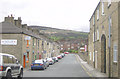
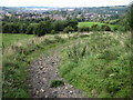
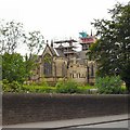
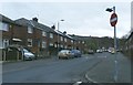
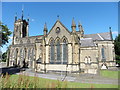
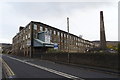
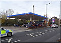
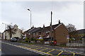
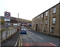
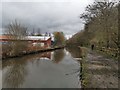
Photos of Stalybridge


Area Information
Stalybridge is a built-up area in England covering 5.7 km², characterised by its compact size and established infrastructure. The area’s demographic profile is notable for its median age of 70, suggesting a community with a significant proportion of older residents. This influences the local character, with a focus on stability and long-term residency. Daily life in Stalybridge is shaped by its proximity to essential services, including a range of primary schools and retail outlets. The town’s accessibility to rail and metro networks, such as Stalybridge Railway Station and Ashton West Metro stop, ensures connectivity to nearby cities. While the area’s population data does not specify household composition, the 63% home ownership rate indicates a mix of owner-occupied properties and rental options. Stalybridge’s blend of practical amenities and transport links makes it a viable choice for those prioritising convenience and established infrastructure over newer developments.
- Area Type
- Built Up Area 250
- Area Size
- 5.7 km²
- Population
- Not available
- Population Density
- Not available
Stalybridge’s lifestyle is shaped by its accessible amenities, including a variety of retail outlets like Tesco and Aldi, which cater to daily shopping needs. The town’s rail and metro connections, such as Stalybridge Railway Station and Audenshaw Metro stop, provide efficient links to nearby cities and suburbs. While the area lacks detailed data on parks or leisure facilities, the presence of multiple schools and retail hubs suggests a community focused on practicality. The compact size of the area means amenities are within walking or short driving distance, supporting a convenient, low-maintenance lifestyle. The mix of retail, transport, and educational options makes Stalybridge suitable for those prioritising accessibility over expansive recreational spaces.
Amenities
Schools
Stalybridge is served by several primary schools, including Ridge Hill Primary School and Nursery, Gorse Hall Primary and Nursery School, Stalyhill Junior School, Arlies Primary School, and Buckton Vale Primary School. Of these, Gorse Hall, Stalyhill, and Arlies have received ‘good’ Ofsted ratings, indicating a reliable standard of education. The presence of five primary schools within the area provides families with multiple options, though no secondary schools are listed. This suggests that parents may need to consider commuting to nearby towns for secondary education. The concentration of primary schools supports young families, but the lack of detailed data on school capacity or performance beyond Ofsted ratings means prospective residents should visit schools to gauge their suitability.
| Rank | A + A* % | School | Type | Entry gender | Ages |
|---|---|---|---|---|---|
| 1 | N/A | Ridge Hill Primary School and Nursery | primary | N/A | N/A |
| 2 | N/A | Gorse Hall Primary and Nursery School | primary | N/A | N/A |
| 3 | N/A | Stalyhill Junior School | primary | N/A | N/A |
| 4 | N/A | Arlies Primary School | primary | N/A | N/A |
| 5 | N/A | Buckton Vale Primary School | primary | N/A | N/A |
Explore more schools in this area
Go to Schools tabDemographics
Stalybridge’s population has a median age of 70, with the most common age range encompassing all demographics. This suggests a community skewed toward older residents, which may influence local services and social dynamics. Home ownership stands at 63%, reflecting a moderate balance between owner-occupied properties and rental housing. The data does not specify household types or accommodation preferences, but the overall home ownership rate implies a stable residential base. The area’s demographic profile does not include detailed information on ethnic diversity or religious composition, but the provided figures indicate a homogeneous population structure. The lack of specific deprivation data means the area’s quality of life cannot be assessed in terms of socioeconomic challenges, though the high home ownership rate may suggest relative stability.
Household Size
Accommodation Type
Tenure
Ethnic Group
Religion
Household Composition
Age
Household Deprivation
NS-SEC
Explore more demographic insights in this area
Go to Demographics tabPlanning
Planning Constraints
- Crime RiskLocked