Area Overview for Stalmine
Photos of Stalmine


Area Information
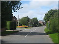
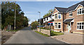
Stalmine is a compact built-up area in England, covering 53.3 hectares. Its character is shaped by a mature population, with a median age of 70, suggesting a community rooted in long-term residency. The area is accessible via multiple transport routes, including rail services at Poulton station and ferry access to Knott End and Fleetwood. Daily life here balances proximity to essential amenities with a quieter, established atmosphere. Retail options like Morrisons, Spar, and Co-op are within walking distance, while nearby metro stops at London Street and Victoria Street connect to broader networks. The presence of Stalmine Primary School, rated 'good' by Ofsted, adds to the area’s appeal for families. Though small, Stalmine offers a mix of practical living with a focus on connectivity and convenience, making it suitable for those prioritising accessibility over urban vibrancy.
- Area Type
- Built Up Area 250
- Area Size
- 53.3 hectares
- Population
- Not available
- Population Density
- Not available
Residents of Stalmine have access to a range of nearby amenities. Retail options include Morrisons, Spar, and Co-op, offering daily essentials. The area’s ferry services to Knott End and Fleetwood provide water-based travel, while metro stops at London Street and Fisherman’s Walk connect to local transport networks. Though parks or leisure facilities are not explicitly named, the presence of multiple retail and transport hubs suggests a practical, community-focused lifestyle. The combination of shops, transport, and coastal access makes Stalmine suitable for those valuing convenience and connectivity over expansive recreational spaces.
Amenities
Schools
Stalmine Primary School is the only named school listed in the area, serving local children with a 'good' Ofsted rating. The absence of secondary schools or other educational institutions means families may need to look beyond Stalmine for comprehensive schooling. The single primary school suggests a community where local education is central, but parents seeking a broader range of schools might find the area’s options limited. This could be a consideration for families planning for long-term educational needs.
| Rank | School | Type | Entry gender | Ages |
|---|
Explore more schools in this area
Go to Schools tabDemographics
The population of Stalmine has a median age of 70, reflecting a community where older residents form a significant proportion. Home ownership is high, with 86% of households owning their homes, indicating a stable, long-term demographic. The data does not specify household composition or accommodation types, but the overall profile suggests a settled population with fewer transient residents. The absence of detailed breakdowns on ethnicity or religion means the area’s diversity remains unquantified, though it is presented as a total. This demographic structure implies a neighbourhood with established social networks and a focus on retirement or long-term residency.
Household Size
Accommodation Type
Tenure
Ethnic Group
Religion
Household Composition
Age
Household Deprivation
NS-SEC
Explore more demographic insights in this area
Go to Demographics tabPlanning
Planning Constraints
- Crime RiskPremium