Area Overview for ST7 2SH
Photos of ST7 2SH
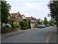
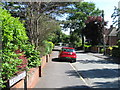
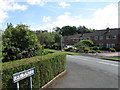

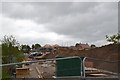
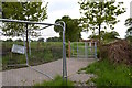
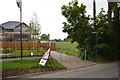
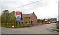
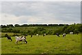
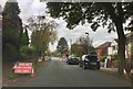

35 photos from this area
Area Information
Key information about the ST7 2SH including its size, population, and administrative classification.
- Area Type
- Postcode
- Area Size
- 6.3 hectares
- Population
- 1884
- Population Density
- 1142 people/km²
House Prices in ST7 2SH
48
Properties
£221,622
Average Sold Price
£63,000
Lowest Price
£530,000
Highest Price
Showing 48 properties
| Address | Type | Beds | Baths | Last Sale Price | Last Sale Date | |
|---|---|---|---|---|---|---|
| 72 Heath End Road, Alsager, ST7 2SH | Semi-detached | 3 | 2 | £276,600 | Sep 2025 | |
| 80 Heath End Road, Alsager, ST7 2SH | Detached | 4 | 2 | £530,000 | Mar 2025 | |
| 69 Heath End Road, Alsager, ST7 2SH | house | 3 | - | £250,000 | Sep 2024 | |
| 63 Heath End Road, Alsager, ST7 2SH | Semi-detached | 3 | 1 | £250,000 | Jul 2024 | |
| 74 Heath End Road, Alsager, ST7 2SH | house | - | - | £265,000 | Nov 2021 | |
| 60 Heath End Road, Alsager, ST7 2SH | Semi-detached | 3 | - | £193,000 | Jun 2020 | |
| 76 Heath End Road, Alsager, ST7 2SH | Bungalow | - | - | £185,000 | Jun 2019 | |
| 52 Heath End Road, Alsager, ST7 2SH | Bungalow | 2 | 1 | £172,500 | Jun 2018 | |
| 92 Heath End Road, Alsager, ST7 2SH | Detached | 4 | 1 | £295,000 | Jun 2018 | |
| 50 Heath End Road, Alsager, ST7 2SH | Bungalow | - | - | £183,000 | Sep 2016 |
Page 1 of 5
Energy Efficiency in ST7 2SH
Amenities
Schools
| Rank | School | Type | Entry gender | Ages |
|---|
Explore more schools in this area
Go to Schools tabDemographics
Household Size
Two person
most common
Accommodation Type
Houses
most common
Tenure
95
majority
Ethnic Group
White
most common
Religion
N/A
most common
Household Composition
N/A
most common
Age
47
median
Adults (30-64 years)
most common
Household Deprivation
N/A
with no deprivation
NS-SEC
52
in Lower managerial occupations
Explore more demographic insights in this area
Go to Demographics tabPlanning
Planning Constraints
- Flood RiskPremium
- Ramsar Wetland SitesPremium
- Area of Outstanding Natural BeautyPremium
- Protected Nature ReservePremium
- Protected WoodlandPremium