Area Overview for ST7 2LN
Photos of ST7 2LN
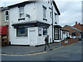
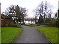

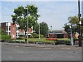
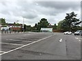


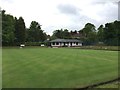
99 photos from this area
Area Information
Key information about the ST7 2LN including its size, population, and administrative classification.
- Area Type
- Postcode
- Area Size
- 1.2 hectares
- Population
- 1699
- Population Density
- 1788 people/km²
House Prices in ST7 2LN
24
Properties
£184,485
Average Sold Price
£28,005
Lowest Price
£875,000
Highest Price
Showing 24 properties
| Address | Type | Beds | Baths | Last Sale Price | Last Sale Date | |
|---|---|---|---|---|---|---|
| 9 Ashmores Lane, Alsager, ST7 2LN | Detached | 5 | 2 | £475,000 | Aug 2025 | |
| 33 Ashmores Lane, Alsager, ST7 2LN | Terraced | 2 | 1 | £202,500 | Aug 2025 | |
| 43 Ashmores Lane, Alsager, ST7 2LN | Detached | 4 | 3 | £875,000 | Jul 2025 | |
| 21 Ashmores Lane, Alsager, ST7 2LN | Semi-detached | 3 | 1 | £237,500 | Mar 2025 | |
| 37 Ashmores Lane, Alsager, ST7 2LN | Retail | 3 | 2 | £272,500 | Jul 2022 | |
| 23 Ashmores Lane, Alsager, ST7 2LN | house | - | - | £200,000 | Aug 2021 | |
| 35 Ashmores Lane, Alsager, ST7 2LN | house | 3 | 2 | £192,500 | Jul 2019 | |
| 7 Ashmores Lane, Alsager, ST7 2LN | Terraced | 3 | 1 | £120,000 | Apr 2015 | |
| The Old Smithy, 13 Ashmores Lane, Alsager, ST7 2LN | Semi-detached | 3 | 1 | £105,000 | Apr 2015 | |
| 2 Ashmores Lane, Alsager, ST7 2LN | house | - | - | £59,750 | Aug 2014 |
Page 1 of 3
Energy Efficiency in ST7 2LN
Amenities
Schools
| Rank | School | Type | Entry gender | Ages |
|---|
Explore more schools in this area
Go to Schools tabDemographics
Household Size
One person
most common
Accommodation Type
Houses
most common
Tenure
83
majority
Ethnic Group
White
most common
Religion
N/A
most common
Household Composition
N/A
most common
Age
47
median
Adults (30-64 years)
most common
Household Deprivation
N/A
with no deprivation
NS-SEC
43
in Lower managerial occupations
Explore more demographic insights in this area
Go to Demographics tabPlanning
Planning Constraints
- Flood RiskPremium
- Ramsar Wetland SitesPremium
- Area of Outstanding Natural BeautyPremium
- Protected Nature ReservePremium
- Protected WoodlandPremium